Millions of years ago, the relief of a great plateau known as Zunbeltz or Lizarraga changed for ever. A gigantic tectonic slip occurred that led to the opening of a wide passage between the mountain ranges of Urbasa and Andía. On the crest between Atlantic Navarre and the Mediterranean watershed, both make up an extensive Natural Park in the west of the region.
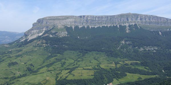
Meadows and leady beech woods alternate in this protected space with an idyllic landscape. Its southern edge falls brusquely onto the Valley of the Améscoas, forming an impressive natural viewpoint over the cirque around the source of the river Urederra.
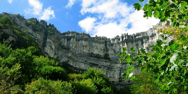
The Information Centres contain information on this Natural Park, its leisure areas, information points, flora and fauna and signposted paths, which will take you through the beauty of woods and rock outcrops. The landscape is dotted with memories of the lifestyles over the centuries of hunters, shephers, woodcutters and charcoal burners. The megalithic station of the Urbasa range is not signposted, so access to it is difficult.
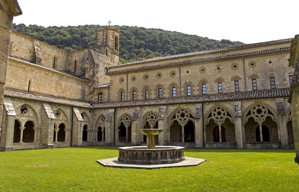
The Urbasa-Andía Natural Park in western Navarre is made up of the Urbasa and Andía mountain ranges. The NA-120 road links Etxarri-Aranatz with Estella-Lizarra and runs along the Andía range. At kilometre 20, just a few metres from the road, you will find a Roman road, a thousand-year-old witness of an era in which it connected Valdega with the Arakil valley. This range contains one of the most spectacular places in the park: the Monastery of Iranzu.
The NA-718 road from Olazti/Olazagutía to Estella-Lizarra crosses the mountain range and you can park your car at several points. It is advisable to visit the Information Centre at the north entrance, where you can find details of the landscape, environment and culture of the Natural Park. In the south, the 'Borda de Severino' - the word 'borda' is used to describe all the huts used by shepherds and livestock -, now converted into a Nature Interpretation Centre, recalls the pastoral way of life. In it a charcoal pile has been reproduced, recalling the traditional customs of the Urbasa mountain range. Several dolmens, menhirs and cromlechs are a testimony to human presence here 100,000 years ago.
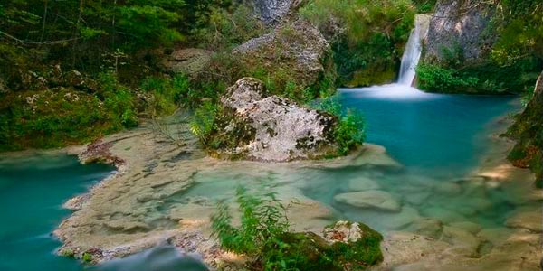
The Natural Park has several viewpoints offering a full panorama of its size and resources: el Balcón de Pilatos (Pilate's Balcony - shown above), located above the cirque at the source of the river Urederra (access from the NA-718 road), the viewpoint at Lizarraga (access from the N-120) and the panoramic table next to the Palace of Urbasa (access from the NA-718).
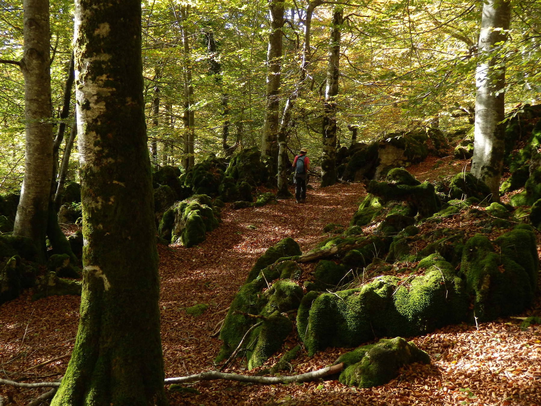
Impressive beech woods cover 70% of the territory, together with other species such as yew, juniper and pine trees. On the rasos, flat land located at around 1.000 metres above sea level, the woods give way to pastures dotted with heather and hawthorns where it is quite common to see mares and sheep grazing; the latter's milk is used to make the delicious Idiazábal cheese.
Another characteristic of this Natural Park is the absence of rivers. The limestone soil allows water to filter through and run underground in numerous chasms and crevasses, so the area is ideal for caving enthusiasts. Sometimes these underground currents emerge in the form of waterfalls. The river sources are spectacular: that of the Urederra in the Urbasa range (access from Baquedano) and of the Ubagua in the Andia range (access from Riezu). Both sites can be reached along easy paths.
Throughout the Natural Park there are other signposted paths with different levels of difficulty that will guide you along their peculiarities. The best known are:
- The 'route of the fountains', a circular path that starts at the Borda de Severino and runs gently for 4.5 kilometres past sources/fountains and beautiful sites.
- The 'route of the shepherds', 7.6 kilometres long, is an easy path that crosses woods and rasos to give you an insight into the livestock rearing activity of Urbasa. It starts at the Information Centre and ends at the Borda de Severino.
- The 3.8-kilometre-long 'mountaineers' route', which provides access to the highest cliff in the north of the range (1,113 m.). The route is of medium difficulty, starting at the Information Centre and crossing the old Camino de la sal (salt route), which was used to transport salt from the nearby village of Salinas de Oro.
- Dulanztz and the Canyon of the Iranzu (Andía), a racket-shaped 18-kilometre-long path long that starts near the monastery of Iranzu and follows the course of the river, initially ascending through leafy woods to the summit of Dulantz.