Mysterious Tales from Spain
Friday, February 13, 2026
Spain is rich in mythology, the entire country is home to towns, cities and buildings that are renowned on account of legends involving ghosts that inhabit them, paranormal phenomena within their walls or tales of impossible love. Many have been handed down from generation to generation. Various cities organise dramatised guided tours that recount tales of mystery dating back in time, often under the moonlit sky to ramp up the emotion. This small selection of just some of these tales, some famous and others not, serves to help those visiting these cities find out a little more about their secrets.
Pedraza Castle, Segovia
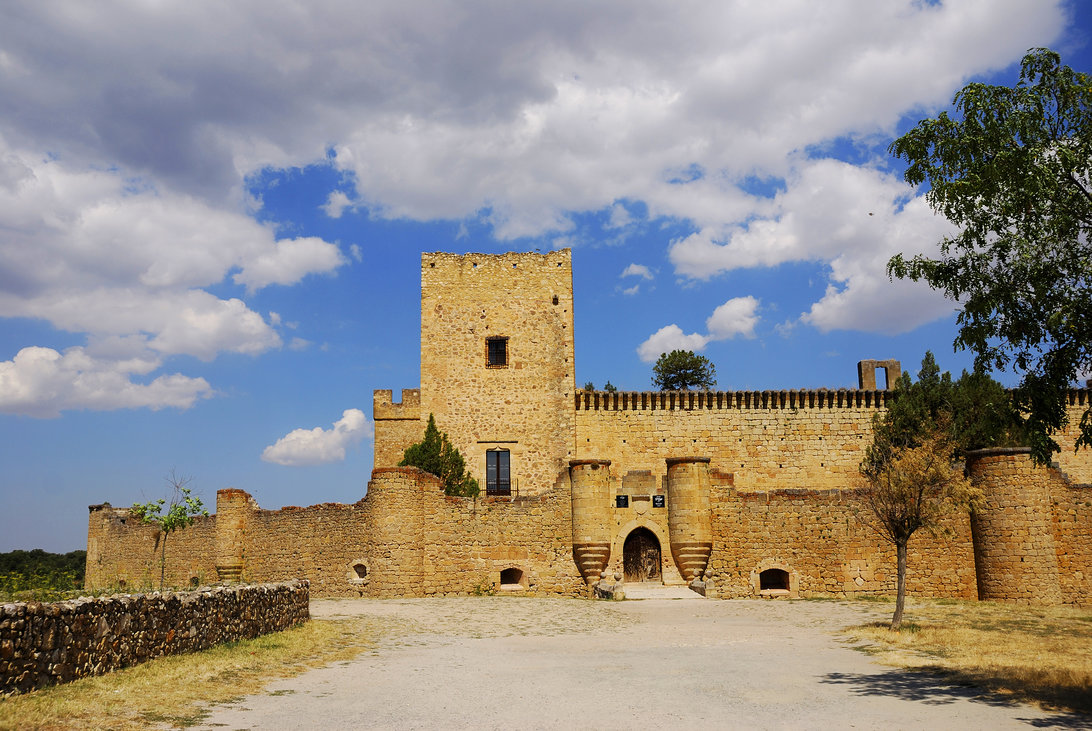
In addition to being renowned for its Noche de las Velas, in which the entire town is lit by candlelight, Pedraza, which has managed to preserve its Medieval essence, is also home to a castle that serves as the backdrop to a mysterious tale of love and vengeance. Legend has it that Elvira and Roberto, lovers who lived in the town, were killed by the lord of the castle, who was infatuated with Elvira. Today, those sleeping at the castle, which belongs to the Paradores of Spain network, report having seen two mysterious figures roaming its passages whose heads are lit by a crown of fire.
The mystery of the girl in the cave and the Pyramids of Güímar, Tenerife
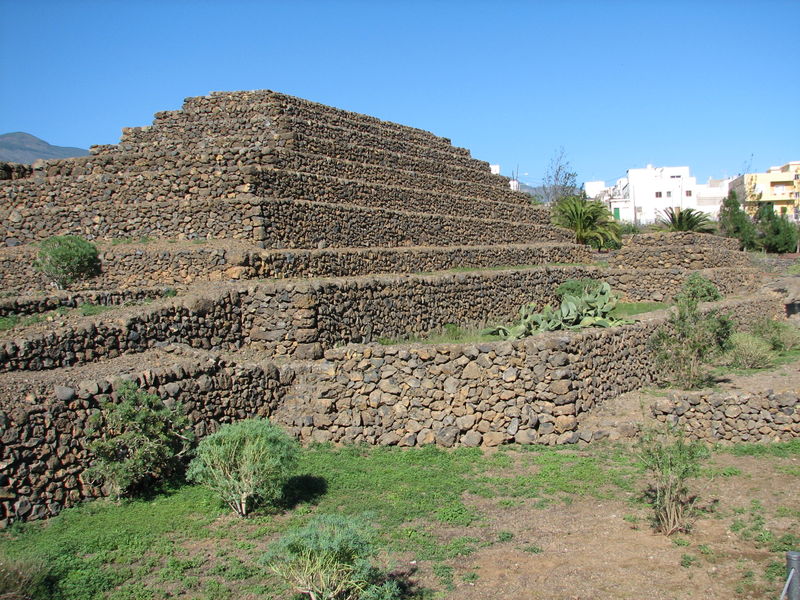
Tenerife is home to various tales, including those involving UFOs. The most famous, however, involve the Badajoz Ravine, in Güimar and the pyramids in the same town. According to an old legend, at the end of the 19th century, a girl went for a walk in the ravine and entered a cave, where she spoke to a strange being. When she returned home, her friends and family had all aged significantly while she remained exactly the same. There is also a legend about the pyramids in the same town, similar to the Egyptian pyramids although somewhat smaller: despite having been studied and various theories debated, their construction remains a mystery to this day. Could it be possible that this island in the Canaries has been visited by extraterrestrials on more than one occasion?
Santa Bárbara Castle, Alacant
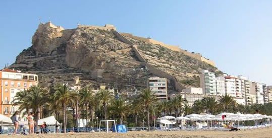
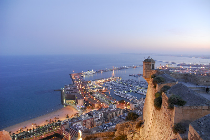
This imposing fortress offers the best panoramic views of the city of Alicante and the Mediterranean Sea. In addition to the famous “Face of the Moor”, a giant rock in the shape of a man's face, the castle is the setting of another tragic love story. Apparently, when these lands were governed by the Moors, the castle was inhabited by a Caliph and his beautiful daughter. She had two suitors. One promised to open a trade route with the East to bring her silk and spices. The other, a young man from a noble family, aimed to win her affections her by opening a dyke and bringing water to the city. The princess gradually fell in love with the latter, but it was her father's wish that the man who set off to India take her hand. The young man then went crazy and threw himself from a ravine. On the same spot, the earth miraculously opened up, with water springing from the mountain, filling what is known today as the Tibi Dam. In her grief, the young bride also threw herself into the abyss from what is now known as the Salto de la Reina Mora (Leap of the Moorish Queen).
Salamanca Cave (Satan's classroom), Salamanca
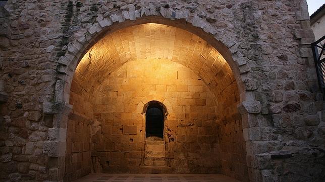
In reality, this cave currently serves as the sacristy of the Church of St Cyprian, in Salamanca. A variety of different tales focus on this site. It has been said that it is the entrance to an underground maze that connects the entire city and is even cited in the works of Cervantes and Calderón de la Barca. Legend has it that here, the devil taught classes in the occult. These classes were attended by seven students, who studied for seven years each. After finishing their studies, one was chosen at random to remain at the service of the devil as payment for his teachings. One of these chosen students was the Marquis de Villena, who fled from the macabre figure; unfortunately, during his flight he lost his shadow, leaving the town's inhabitants to conclude that he worshipped Satan.
La Cruz del Diablo, Cuenca
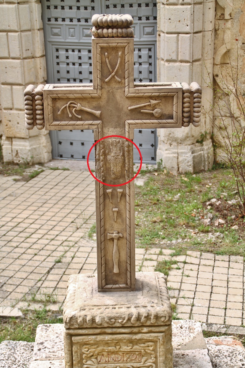
This city is bursting with mystery; in fact, it is one of the cities where guided night-time tours are offered to discover more about its legends. One of the most popular tales is about La Cruz del Diablo. According to local residents, a brash young man, known for his party animal spirit, met a beautiful girl. His plight to win her affections in order to prove his heartthrob status finally won her over. Their date took place on a cold, stormy night. Lightning struck nearby, lighting up what should have been the girl's beautiful legs; however, what the man actually saw were claws. He fled in terror and reached the Convent of the Barefoot Carmelites, where he hung on tightly to the cross, asking for divine help to prevent him from being taken by the devil. To this day, his handprint can be seen on the cross.
Linares Palace, Madrid
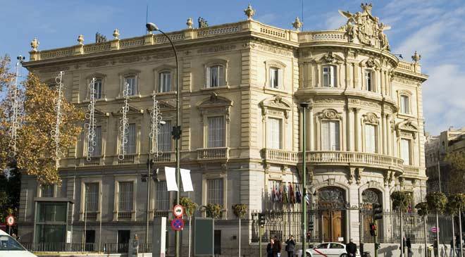
The Spanish capital is home to numerous enchanted buildings that set the scene for entertaining tales. Linares Palace, located in Plaza de Cibeles, is just one example. Apparently, a scandal concerning the romance between the Marquises of Linares, who were supposedly siblings on their father's side, resulted in a daughter who they locked in the palace to prevent gossip. Legend has it that the spirit of the girl haunts the palace's rooms, singing nursery rhymes and calling for her parents. With or without its ghostly inhabitant, this emblematic Neo-Baroque building in Spain's capital is spectacular.
The Legend of Cambaral, Luarca
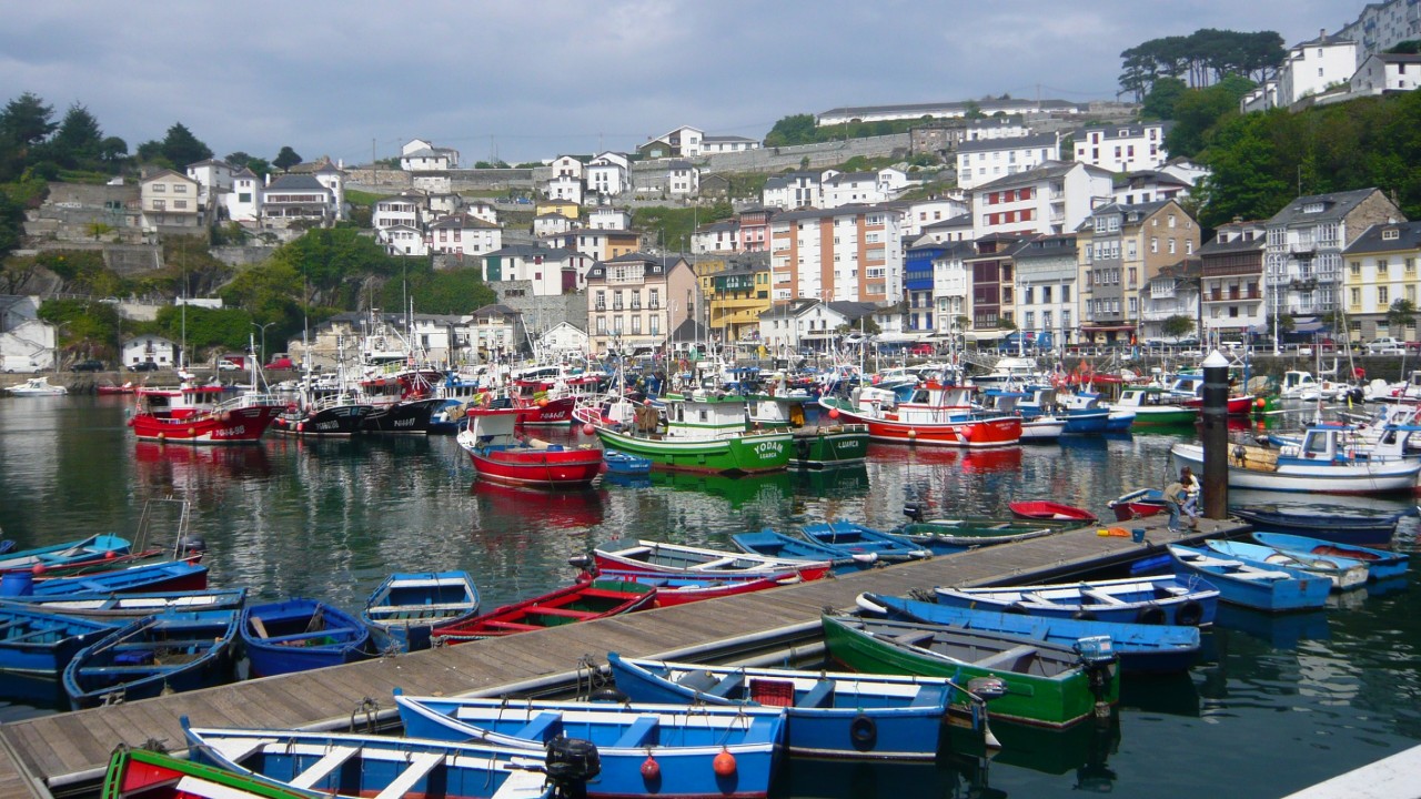
It is no surprise that this town, with its deeply-rooted seafaring tradition, is home to various tales involving pirates. Cambaral, renowned as the fisherman's district, was named after a famous pirate that terrorised the region's residents until he reached this Asturian town. Here, he was captured and badly injured. A beautiful young local woman was responsible for healing his wounds during his captivity. They fell in love and decided to run away together; however, they would meet their demise at her father's hands, as he would decapitate both of them in their escape. The story goes that they remained in an embrace while their heads rolled into the sea. The Puente del Beso (Kissing Bridge) was built in the town in their remembrance; those visiting the bridge at night report having heard the sound of the lovers speaking to one another from the bottom of the sea.
 4
Like
Published at 7:02 PM Comments (0)
Tilting at Windmills: A Literary Road Trip Through the Heart of Inland Spain
Friday, January 23, 2026
Beyond the crowded beaches of the Costa del Sol and the bustling streets of Madrid lies a landscape that feels suspended in time. It is a land of vast, arid plains, whitewashed villages, and rolling hills crowned by stone fortresses. This is Castile-La Mancha—the legendary setting of Miguel de Cervantes’ Don Quixote.
For those seeking a journey that blends history, culture, and literature, the Ruta de Don Quijote offers a 300-kilometre circuit that brings the world's most famous knight-errant to life. Here is how to navigate this iconic loop through the soul of inland Spain.
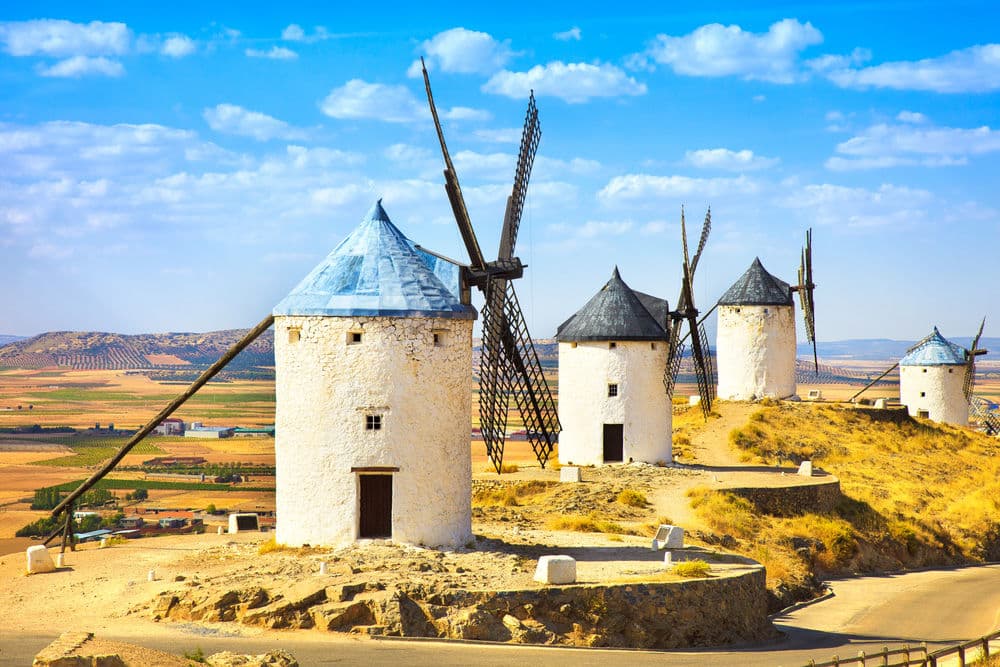
Every great quest needs a starting point, and there is none grander than Toledo. Once the capital of the Spanish Empire, this "City of the Three Cultures" sits dramatically on a gorge overlooking the Tagus River.
Before hitting the open road, wander through the labyrinthine streets where Christian, Muslim, and Jewish legacies intertwine. From the towering Alcázar to the intricate Gothic cathedral, Toledo serves as the cultural anchor for the route. It is here that you can find numerous exhibitions dedicated to Cervantes, preparing you for the immersion into his fictional world.
Driving sixty kilometres south, the horizon begins to shift. Emerging from the plains of La Mancha is the "Ridge of Peace" in Consuegra. Here, twelve white windmills stand in a row like silent sentinels against the sky.
It is impossible to view these structures without thinking of the famous scene where Quixote, fueled by his imagination, charges at them, believing they are monstrous giants. Next to the windmills sits the Castle of La Muela, a sturdy fortress that offers panoramic views of the scorched earth below—a landscape that has changed remarkably little since the 17th century.
Further south lies Puerto Lápice, a village that retains the charm of a medieval crossroads. The highlight here is the Venta del Quijote, a traditional Castilian inn built around a central courtyard with wooden galleries.
In the novel, this is the spot where Don Quixote was "knighted" by a bewildered innkeeper. Today, it remains a perfect place to stop for a meal of local Manchego cheese and wine, allowing you to soak in the atmosphere of an era when travellers on horseback were the norm.
A short drive leads to Alcázar de San Juan, a town steeped in both Roman history and literary mystery. Local legend claims that the Church of Santa María la Mayor houses the very baptismal font used for Miguel de Cervantes himself. Beyond the literary connection, the town’s Plaza de España, with its arcaded galleries, showcases the architectural wealth of the Spanish Golden Age.
While Consuegra is famous for its vista, Campo de Criptana is home to the most authentic windmills in the region. Several of these 16th-century structures, such as the Molino Infanto, still contain their original internal mechanisms. Walking through the town’s whitewashed streets, decorated with vibrant flower-filled courtyards, feels like walking through a life-size film set dedicated to rural Spanish tradition.
No Quixotic journey is complete without a visit to El Toboso, the home of the knight’s idealised lady, Dulcinea. The town is home to the Casa-Museo de Dulcinea, a beautifully preserved 16th-century house that recreates the domestic life of the period. As you stroll past the Church of San Antonio Abad and through the quiet, sun-drenched plazas, the line between Cervantes’ fiction and Spanish reality begins to blur.
The Ruta de Don Quijote is more than just a sightseeing tour; it is an invitation to see the world through a different lens. In the heart of inland Spain, the windmills are still turning, the castles still stand guard, and the spirit of the "ingenious hidalgo" lives on in every dusty road and blue-framed window. For the modern traveller, it is a reminder that sometimes, the most rewarding journeys are those fueled by a bit of imagination.
 1
Like
Published at 9:41 PM Comments (1)
Celebrating the Day of the Kings in Spain
Friday, January 2, 2026
The "Día de los Reyes" or the Day of the Kings, also known as the Epiphany, is one of the most cherished and widely celebrated holidays in Spain. Held on January 6th, this day commemorates the visit of the Three Wise Men, also known as the Three Kings, to the baby Jesus in Bethlehem. The celebration is rich in traditions that reflect the cultural and religious heritage of Spain. Here, we delve into the diverse customs that make this day special.

The Parade of the Three Kings
One of the most awaited events associated with the Day of the Kings is the "Cabalgata de Reyes," or the Parade of the Three Kings. On the evening of January 5th, towns and cities across Spain come alive with vibrant parades reenacting the journey of the Wise Men—Melchior, Gaspar, and Balthazar—towards Bethlehem. The streets are filled with elaborate floats, music, dancers, and costumed participants.
The Three Kings, portrayed by locals, ride majestically atop their floats or on horses and camels, tossing candies and small gifts to the eager children lining the streets. Each King is typically dressed in ornate robes and crowned, embodying the luxurious and exotic aura of the biblical Magi. The parades vary in grandeur, with some cities like Madrid and Barcelona hosting particularly elaborate and theatrical displays.

The Tradition of Gifts
In Spain, the custom of gift-giving is closely tied to the Day of the Kings rather than Christmas. Spanish children write letters to the Three Kings, much like other children might write to Santa Claus, detailing their wished-for gifts. On the eve of January 6th, children leave their shoes out, sometimes filled with straw or hay for the Kings’ camels. That night, the Wise Men are believed to visit homes to leave gifts and sweets for the well-behaved children while delivering coal, often in the form of a sugar confection called "carbón dulce," to those who have misbehaved.
The King's Cake – Roscón de Reyes
An integral part of the Day of the Kings is the "Roscón de Reyes," a ring-shaped sweet bread adorned with candied fruits and sometimes filled with whipped cream or custard. The Roscón often hides a small figurine of a King and a dried bean. Tradition holds that whoever finds the figurine in their slice is crowned 'King' or 'Queen' for the day, sometimes with a paper crown that accompanies the cake. On the other hand, the person unlucky enough to find the bean is tasked with buying the next year's Roscón or an invitation to host the next gathering.

Family Gatherings and Festive Meals
Like most Spanish festivities, the Day of the Kings is marked by a joyous gathering of family and friends. After the excitement of the morning gifts, families come together for a lavish meal. Dishes vary by region but commonly include rich stews, roasts, seafood, and a variety of traditional sweets. The Roscón de Reyes is often the centrepiece of the dessert spread, enjoyed with hot chocolate or coffee.
The Day of the Kings stands as a testament to Spain's deep-rooted traditions and cultural vibrancy. From the magic of the parades to the joyful gift-giving and communal feasts, each aspect of the celebration encapsulates a blend of religious significance and festive cheer. Though the customs may vary slightly from one region to another, the enduring spirit of the Epiphany unites Spaniards in a shared experience of joy, generosity, and family togetherness, ensuring that the Day of the Kings remains a beloved fixture in the Spanish holiday calendar.
 4
Like
Published at 6:25 PM Comments (0)
Wishing you a Sweet Christmas and New Year!
Friday, December 26, 2025
Perhaps the most traditional Christmas sweet in Spain is marzipan, a paste of almonds and sugar. There are various theories about its beginnings, although it is certain to have originated in the Mediterranean area, where almonds come from. The stories of the Thousand and one nights mention it as an aphrodisiac, and as a restorative during Ramadan. Others say it first came from convents, many of which still make it. When there was a wheat shortage after the battle of Las Navas de Tolosa (1212), the nuns began making these sweets with what they had in the larder: almonds and sugar. In Toledo, famous for its marzipan, they used to stamp an image of the King on his throne on the marzipan cakes, copying the city's crest. Curiously, "the King seated", in Arabic, sounds like mauthaban, very similar to the Spanish mazapán. So the debate continues.

What we can be sure of is that to eat the finest marzipan, you should go to this city in La Mancha, where you can also find traditional variations: anguilas or "eels" with an angel-hair squash filling, thought to have been first made for King Philip III as a gift for the King of Portugal; delicias in the form of a crescent moon, filled with egg paste; castañas, in the form of chestnuts, dipped in chocolate; and empiñonadas, covered in pine nuts.
Turrón also seems to have a Muslim origin. A mixture of almonds and honey, called turun, appears for the first time in the book De medicinis et cibis semplicibus, written by an 11th-century Arab doctor. In the 16th century, Philip II's royal cook, Don Francisco Martínez Montiño, comments in his book Conduchos de Navidad that Jijona smells of honey everywhere, because turrón is made in every household. In 1991 the Regulatory Council of the Designation of Jijona was formed, and although traditional turrón is made with almonds and honey, both abundant around Valencia, modern variations can include egg yolk, candied fruit or nuts.
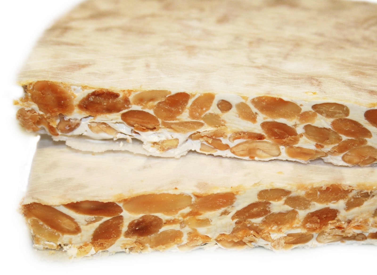
As with most culinary inventions, mantecados or lard cakes also arose to meet a need. In the 16th century there was a surplus of pork lard and of cereals, particularly around Seville. In Estepa they decided to mix the lard and flour, adding olive oil, sugar and egg-white, to make mantecados.
Here there is no possibility of an Arab origin. According to their Protected Geographical Indication, mantecados originated in the Convent of Santa Clara in Estepa, where they were first made as flat cakes, and later as the little cakes we see today. Today they can include coconut, cinnamon, sesame seeds and even chocolate. The polvorón is a very similar sweet which was first made around the same time, but includes almonds.

Christmas meals with children, especially in Catalonia and Aragon, often finish with a type of chocolate-covered Swiss roll. At first sight it looks like a log, but it’s actually a cake filled with cream, the Tronco de Navidad. No-one is sure why these two regions in north-eastern Spain borrowed the Buche de Noel from their French neighbours, who in turn took the idea from the Nordic tradition of the Yule log, where in the northern hemisphere a tree-trunk was burned at the winter solstice between 20 and 23 December as a symbol of prosperity. Like the cake, the log was decorated with flowers, pieces of orange and nuts. In Great Britain, Belgium, and then France, many people took up the tradition of the Yule log, but it fell from favour when enclosed stoves began to be used for heating. A French cake-maker found a solution with this dessert, which quickly became popular in the late 19th century.

And finally we come to the cake that ends the Christmas season in Spain on 5 or 6 January, depending on the customs of each household: roscón de Reyes. The first people to eat a ring-shaped cake were the Romans, during Saturnalia, also known as the slaves' holiday, because they didn’t have to work. A broad bean would be hidden inside the cake, a symbol of the prosperity that would come in Spring, and of Saturn, the god of agriculture. They spread the tradition all over Europe, but after the arrival of Christianity it endured only in France, where the royal household made the cake with a coin hidden inside. These days it remains a firm tradition in much of Spain, especially in Madrid, accompanied by hot chocolate, and in Latin American countries such as Mexico.
 2
Like
Published at 3:43 PM Comments (0)
Discover 5 miles of underground wine cellars
Friday, December 5, 2025
Aranda de Duero is a small town, where just about everywhere worth going is within walking distance. It takes about 30 minutes to walk from one end of the town to the other, but quite a bit longer if you choose to stop off to eat, drink, and socialise along the way—which is almost inevitable.
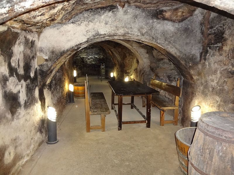
A provincial town about 150 kilometres (93 miles) from Madrid, Aranda is the capital of the Ribera del Duero wine region (which is also famous for its lamb dishes). While there are many interesting places to visit nearby—Roman ruins, castles, walled villages, and so on—what makes Aranda so unique is the extensive network of underground wine cellars that interconnect below the streets of the town centre.

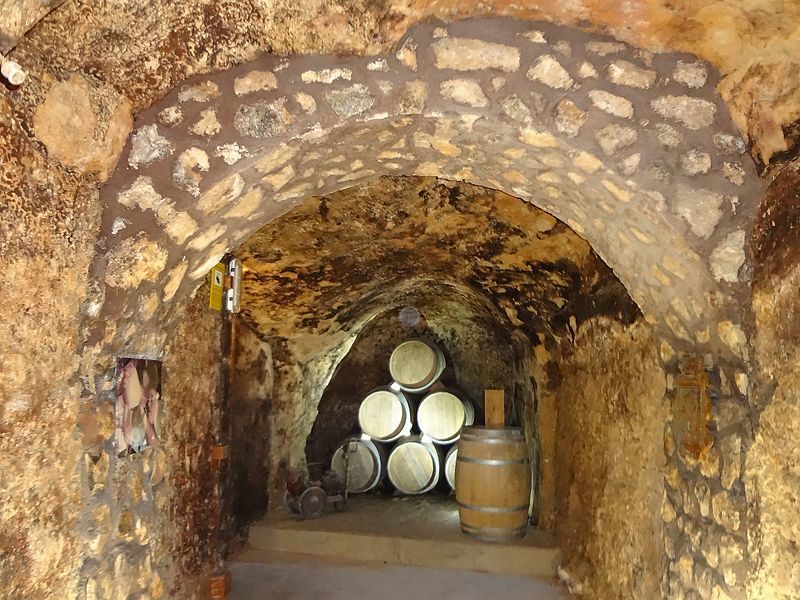
Used since the Middle Ages, there are currently about 135 cave-based wine cellars, or “bodegas,” under Aranda del Duero (many others have either collapsed or are no longer used for winemaking). The 5-mile-long network of caves is about 24 to 33 feet deep. Most of the cellars are interconnected and divided just by wooden doors.
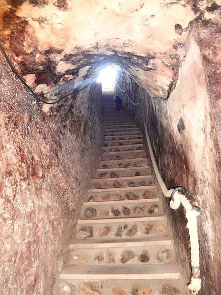 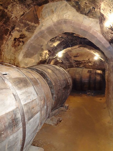
Many of these cavernous wineries offer guided tours and tastings, and obviously, all will try to sell you their wine (which is hard to resist). The winery of Don Carlos, built in the 15th century, invites visitors to explore the cave as part of a performance by costumed actors. Various clubs ó “peñas,” celebrate special events in these cellars and these clubs are clearly marked at street level. With a total length of around 7 km and excavated at a depth of 13m, the underground cellars of Aranda form the main tourist attraction of the city and undoubtedly show us part of the history of the Ribera del Duero.
The economy of the town, closely linked to wine, forced the locals of the 14th and 15th centuries to dig the cellars under their houses producing this network of incredible tunnels that were originally destined for the conservation of wines.
The medieval wine cellars of Aranda have a constant temperature and humidity throughout the year (if you happen to visit in the hot months, make sure you bring a jacket)
They possess an ingenious construction called zarcera, thanks to this, the historical cellars enjoy an excellent ventilation coming from the outside. These characteristics, together with the absence of noise and vibrations, made the wineries the ideal place for the elaboration and conservation of local wines until well into the last century.
The bodegas were designated as ”Assets of Cultural Interest” by the Spanish Government in 2015.
https://www.bodegasdearanda.com/en/visitas-y-catas/
 4
Like
Published at 6:11 PM Comments (1)
The Letter That Almost Disappeared
Friday, November 21, 2025
 Ñ is the 15th letter in the Spanish alphabet and is used in more than 15,700 words. There’s no "Español" without ñ but even worse there would be no "cañas" either. The letter ñ was first included in the dictionary of RAE in 1803. But its origins stretch to the Middle Ages. The letter first appears in a text dating back to 1176. Ñ is the 15th letter in the Spanish alphabet and is used in more than 15,700 words. There’s no "Español" without ñ but even worse there would be no "cañas" either. The letter ñ was first included in the dictionary of RAE in 1803. But its origins stretch to the Middle Ages. The letter first appears in a text dating back to 1176.
Neither the sound or the letter ñ existed in Latin, but as the Latin language evolved and romantic languages such as Spanish, French and Italian began to appear, so too did the palatal nasal sound, which is articulated with the back of the tongue raised to the hard palate - the movement required to pronounce the ñ.
In the Middle Ages, monks were the scholars and the monasteries were the centres of knowledge. The letter ñ is thought to have originated at this moment in time due to the shortage of scrolls, which were very costly, and all efforts were made to maximise the efficiency of space on each scroll. As a result, it is believed that the monks were forced to abbreviate some double letters in order to fit more words in each line. According to this theory, the second repeated letter was represented as a tilde over the first. In other words, what we know as the ñ is in fact a double n, so instead of donna, we have doña.
However, there is another theory about the origin of this letter. According to this theory, the letter ñ emerged as a way to represent the new palatal nasal sounds that appeared in the ninth century. These words meant more work for the monks and so different adaptations began to emerge depending on the language. The letter ñ was used in Spanish and Gallego (España); the nh combination in Portuguese (Espanha); gn in French and Italian (Espagna); and ny in Catalan (Espanya).
These different forms continued to be used interchangeably until the 13th century when King Alfonso X of Castile and León ordered a spelling reform as part of his policy of linguistic unification. The monarch introduced the letter ñ as the preferred option to the previous combinations and in doing so set the first rules of the Spanish language. When the use of ñ became widespread across the Iberian peninsula, humanist Antonio de Nebrija included the letter in the first Spanish grammar book in 1492.
But it was not too long ago that the letter ñ was in danger of disappearing, at least from the written language. In the 1990s, the European Economic Community (EEC) proposed eliminating the ñ to make computer keyboards more uniform. It was not until October 2, 2007, that the ñ, as well as other tildes, could appear in email addresses and web domains.
The controversy ended on April 23, 1993, when the Spanish government approved a royal decree that maintained the mandatory inclusion of the letter ñ on keyboards.
But it is important to note that neither the letter ñ nor the sound is exclusively Spanish. In the Iberian peninsula, it is used in Gallego and Asturian, and also to a limited degree in the Basque language Euskera. In Latin America, many indigenous languages also include the letter, such as Mapuche in Chile and Argentina, Zapotec in Mexico and Quechua in Ecuador.
 6
Like
Published at 10:58 PM Comments (1)
Adios, Pan? Why Spain is Saying 'No' to its Daily Diet of Bread
Friday, November 14, 2025
For decades, the image of Spain was inseparable from its bread. The long, crusty barra de pan (baguette) was the constant companion to every meal, used to scoop up the last drops of olive oil, mop up salsa, and serve as the backbone of every bocadillo.

Yet, that staple of the Spanish table is rapidly disappearing. Data shows that bread consumption in Spain has plummeted by a staggering 80% since the 1960s, falling from an estimated 134 kilograms per person per year to around 28 kilograms today. This dramatic cultural shift is doing more than just changing mealtimes; it is reshaping the country's diet and devastating its traditional bakeries.
What is driving this monumental change in a country deeply rooted in the Mediterranean diet? The reasons are a complex mix of health myths and generational shifts:
-
The "Bread Makes You Fat" Myth: This is arguably the most influential factor. Despite being a low-fat food, the persistent, incorrect mantra that "bread makes you fat" has profoundly impacted public perception. Studies indicate that nearly 30% of Spaniards now try to follow a bread-free diet, while another quarter do not consider it necessary for balanced nutrition.
-
The Generational Divide: Younger Spaniards are increasingly replacing bread with other, more globally popular carbohydrates. Rather than pan being the go-to starch, the modern generation often prefers alternatives like pizza and pasta.
-
The Gluten Concern: Following global trends, many Spanish consumers, even without a diagnosed intolerance, have reduced or eliminated gluten-containing products, further pressuring traditional bread sales.
The cultural rejection of daily bread has had a crushing effect on the industry that defines local neighbourhoods:
-
Bakery Closures: Since the turn of the century, an estimated 40% of traditional bakeries (panaderías) have closed their doors.
-
Shift to Industrial Bread: As daily consumption falls, sales have moved away from skilled bakers to large supermarkets and gas stations, where highly processed, industrial, and often less flavourful loaves dominate the market.
-
Rising Prices: Compounding the problem for the consumer, the price of bread has risen significantly—up approximately 30% in the last decade, making bulk purchase less appealing.
Despite the overall decline, there is a positive counter-trend that expats, in particular, have enthusiastically embraced: the rise of artisanal bread.
Spanish consumers are increasingly moving towards high-quality, speciality breads. This demand is for loaves crafted using traditional methods, long fermentation, and quality ingredients—such as rustic sourdough (pan de masa madre) and whole-grain varieties.
This shift suggests that while bread may no longer be the cheap, obligatory filler for every meal, it is re-establishing its prestige as a gourmet, high-value food item. Instead of mindlessly consuming 130 kg of low-quality bread a year, Spaniards are now choosing smaller amounts of superior, traditionally made bread.
For those of us living in Spain who appreciate the rich culinary heritage, the best way to combat this decline is simple: seek out and support your local, artisan baker. Choose quality, complex flavours over convenience, and help keep the heart of Spain's baking tradition alive.
 3
Like
Published at 11:05 PM Comments (2)
How Halloween Took Root and Flourished in Spain
Friday, October 31, 2025
Spain, a nation celebrated for its deep-seated traditions like Día de Todos los Santos (All Saints' Day) on November 1st, has, in recent decades, enthusiastically embraced the global phenomenon of Halloween. What started as an "imported" holiday has blossomed into a vibrant, multi-layered celebration that skillfully blends modern fun with ancient Iberian and Celtic roots.

The relationship between Spain and the end-of-October observance is surprisingly complex, with both ancient roots and a relatively recent, rapid expansion:
-
Ancient Celtic Heritage (Samaín): The eerie roots of Spain's association with this time of year can be traced back thousands of years to the northwestern region of Galicia. Here, the ancient Celtic festival of Samhain ("end of summer") was celebrated. This traditional festival, known locally as Samaín or Noite dos Calacús (Night of the Pumpkins), marks the time when the veil between the living and the dead is thinnest.
-
Traditions: Even today, the modern revival of Samaín in Galicia involves carving pumpkins (or sometimes turnips), sharing ghost stories, lighting bonfires, and performing rituals like La Queimada (a flaming alcoholic punch with spells) to ward off evil spirits.
-
The Deep-Rooted Traditional Focus (Día de Todos los Santos): For centuries, the main focus in Spain has been the solemn and reflective Día de Todos los Santos on November 1st, followed by Día de los Fieles Difuntos (All Souls' Day) on November 2nd. These are national holidays dedicated to honouring the dead.
-
Customs: Families visit cemeteries to clean and elaborately decorate the graves of loved ones with fresh flowers, especially chrysanthemums, turning the cemeteries into vibrant places of remembrance and respect.
-
The American Cultural Tide: The rapid growth in the importance of Halloween (October 31st) began in the late 1980s and 1990s, largely driven by Anglo-Saxon cultural influence, particularly from the United States. Globalisation, horror movies, and television were key in introducing the now-familiar imagery of Jack-o'-lanterns, elaborate costumes, and "trick-or-treating" to Spanish society.
-
Growth: In large cities like Madrid and Barcelona, the celebration first gained a foothold in international schools, bars, and foreign communities. By the 2000s, the holiday was firmly established, especially among children and young people.
Modern Halloween in Spain is characterised by a fascinating mix, often celebrated over a three-day period that includes October 31st, November 1st, and November 2nd.

Modern Festivities on October 31st
The day, sometimes referred to as Día de las Brujas (Day of the Witches), is now a major occasion for contemporary celebration:
-
Costume Parties and Nightlife: Adults embrace the party spirit, with nightclubs, bars, and even themed events in amusement parks going all-out with elaborate decorations and costume parties.1 ostumes often lean toward the traditional spooky and macabre—ghosts, zombies, and vampires—though pop culture figures are increasingly common.
-
"Truco o Trato" (Trick-or-Treating): While not as universal or elaborate as in the US, "truco o trato" is now common in many urban neighbourhoods, schools, and community centres, especially for younger children.
-
Urban Spookiness: Cities like Barcelona and Málaga organise public parades, zombie marches, and haunted house experiences, creating a major spectacle.
The Culinary Bridge to All Saints' Day
The transition from the playful fright of Halloween to the reverence of All Saints' Day is often marked by traditional autumn foods, shared by families and friends:
-
La Castanyada (Catalonia): In Catalonia and parts of the north, the focus is on this traditional autumn festival, where people gather to eat castanyes (roasted chestnuts), boniatos (sweet potatoes), and panellets (small almond-based marzipan cakes).
-
Huesos de Santo: Across Spain, bakeries sell Huesos de Santo ("Saint's Bones"), small, marzipan-filled pastries, and Buñuelos de Viento (fried cream-filled fritters), tying the festivities to the religious holiday.

The Reverence of November 1st
Crucially, the fun of Halloween doesn't overshadow the respect for Día de Todos los Santos. Many Spaniards—particularly older generations—still prioritise this day of reflection, which offers a poignant contrast to the revelry of the previous night. It remains a significant family occasion centred on memorial, cemetery visits, and sharing special meals.
Halloween in Spain today is a perfect example of cultural syncretism. It successfully maintains ancient, local rituals in regions like Galicia, while simultaneously integrating the fun, commercialised appeal of the Anglo-Saxon holiday into its modern urban life, all while respecting the solemn, family-focused tradition of All Saints' Day. It has grown from a novelty to an established, highly anticipated event.
 2
Like
Published at 9:20 PM Comments (0)
Home to the First Europeans - Burgos
Friday, October 24, 2025
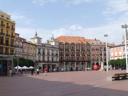
The province of Burgos, with its present borders, dates back to the mid-19th century, and its capital, the City of Burgos, to the year 884 when it was founded by Count Diego Rodríguez Porcelos due to the population migrating down from the mountains in the north to the plains of the northern Meseta (central plateau). But the history of this area, and especially its pre-history, extends much further back…
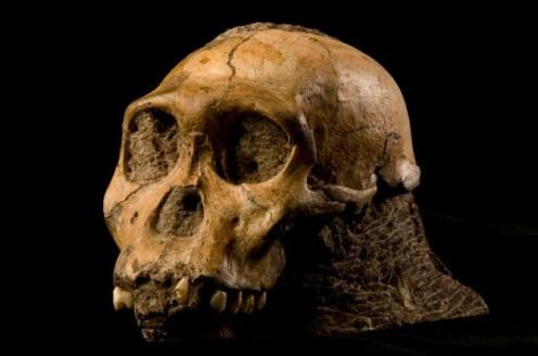
Human activity has left a deep and indelible mark on the province of Burgos. The most outstanding page from the past of Burgos must be sought in the hominid sites of Sierra de Atapuerca, where remains from over one million years ago have appeared of what has been considered as the first European. The excavations at Sierra de Atapuerca have permitted the modern world to rewrite the history of Europe and to know how we have evolved for millions of years. So far, they have found five different species: Homo Sp. (still to be determined, 1,200,000 years), Homo Ancestors (850,000 years), Homo Heidelbergensis (500,000 years), Homo Neanderthalenis (50,000 years,) and, of course, Homo Sapiens (us). The sanctuaries of cave paintings of Ojo Guareña; the dolmen group of Las Loras; the copious forts and necropolis of the Iron Age; the Roman town of Clunia and a considerable series of high-mediaeval necropolis and hermitages in La Demanda and Las Merindades are also of great importance to the province.
 .jpeg)
Burgos is a territory where the historical origins of Castile were gestated and where the Castilian language was born, it is a province sown with incomparable and extremely beautiful samples of the cultural and artistic heritage. Its varied regions and towns are studded with churches, hermitages, monasteries, palaces, towers and castles from all times and styles. All of these remains are the unmistakable testimony of a dense and almost incomparable history. Few territories can boast such variety, quantity and quality of monuments.
The landscape of the province of Burgos radically breaks with the cliché that identifies Castile with an enormous and arid plateau. Mountains and plains form a relief where the strong contrast of its elements stand out. An enormous mosaic of ecosystems and natural landscapes, the ideal place to forget about the stress of busy town life and escape from the southern sweltering heat in summer and let yourself be carried away by the murmur of the water and wind.
The Province of Burgos is the centrepiece of the path traced by the Road to Santiago on the Iberian Peninsula. The strategic geographic placement of the Province of Burgos made it a necessary zone of transit for the millions of European pilgrims who made their way towards the Tomb of Santiago the Apostle from their home countries.
Over the course of the nearly 114 kilometres that cross its territory can be found an impressive collection of cultural landmarks. Its principal points of interest include Redecilla del Camino, Belorado, Villafranca Montes de Oca, San Juan de Ortega, the city of Burgos, San Antón and Castrogeriz.
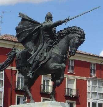
Rodrigo Díaz de Vivar, known as “El Cid” Campeador, is Burgos' most universal figure. When examining the life of El Cid, a distinction must be drawn between two figures: the historic figure, about which there is a fair amount of information, and the literary figure created by the Poema de Mío Cid and by the Romancero. The historic El Cid was born around 1048. According to tradition, he was born in the nearby town of Vivar del Cid, though there is no reliable testimony. In his youth, he developed a friendship with the future king Sancho II, of whom he was a faithful vassal from 1065 to 1072. Upon the king's death, he immediately entered the service of Alfonso VI, and carried out different missions under the orders of the monarch. His good relationship with the king ended in 1081 when he attacked the Muslim lands of Toledo with his private army and without the consent of the King. The incident sent him into exile, which forced him to live off his military skills in foreign lands, first under the Muslim king of the taifa of Zaragoza, and following his reconciliation with Alfonso VI in 1087 and after several months of direct service to his king in Castile, in Levante where he spent the last twelve years of his life, first as the delegate of the Castilian king, and after being taken prisoner in 1088, in a second exile, as an independent warrior and prince of the Muslim kingdom of Valencia, in whose capital he died in 1099. A memorial statue of El Cid can be found in the centre of The City of Burgos.
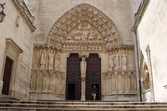
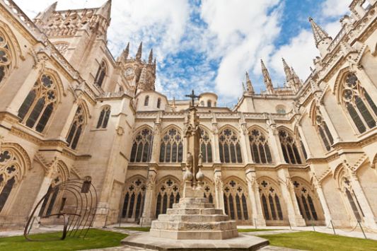
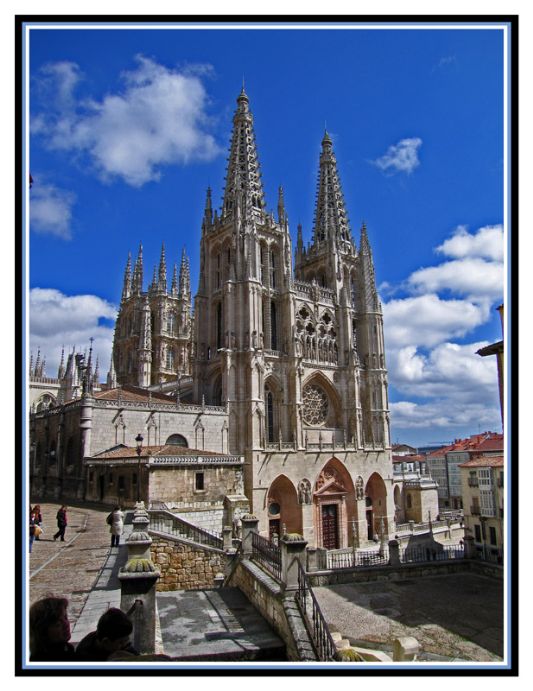
One of the City of Burgos’ most important monuments is the Cathedral of Santa Maria. Built on the location of the original Romanesque cathedral, the first stone was laid in 1221 by King Ferdinand III and Bishop Don Mauricio. The main façade has the Royal Gate, also known as the Gate of Pardon, which was refurbished in the 18th century, and a large rose window and gallery with 8 statues of the monarchs of Castile beneath the statue of the Virgin Mary and the inscription “Pulcra es et Decora”. On both sides are the 84-metre towers crowned with slender spires from the 15th century, by Juan de Colonia. The tympanum of the Sarmental Gate, from the 13th century, shows Christ the healer with the four evangelists and, on a ledge below, the twelve apostles, with monarchs and musicians.
The mullion shows Bishop Don Mauricio with prophets and apostles to the sides. Above it, a beautiful rose window. The Coronería Gate, also known as that of the Apostles, is Gothic and shows Christ the Judge between Our Lady and St. John and, to the sides, a complex and majestic apostolate. The Pellejería Gate was built in 1516 by Francisco de Colonia. Above the transept is the dome, which was built in the 16th century and involved work by the masters Felipe de Vigarny and Juan de Vallejo. The chapel of El Condestable was built at the upper end by Simón de Colonia in the 15th century. It boasts a magnificent decoration of coats of arms and slender spires that form, together with those of the transept and those of the towers, an inimitable forest of stone with a wealth of statues and filigree work.
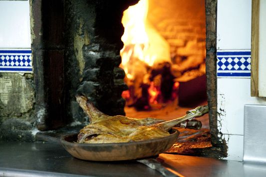
But Burgos isn’t just about monuments; with so much history it is hardly surprising that it is also a centre for gastronomy. Several of the dishes and preparations of the Burgos cuisine have gone beyond the provincial limits and have become the stars of the national culinary art. Suckling lamb roasted in a wood oven, rice black pudding and the fresh cheese from Burgos are the most well-known.
 .jpeg)
 .jpg)
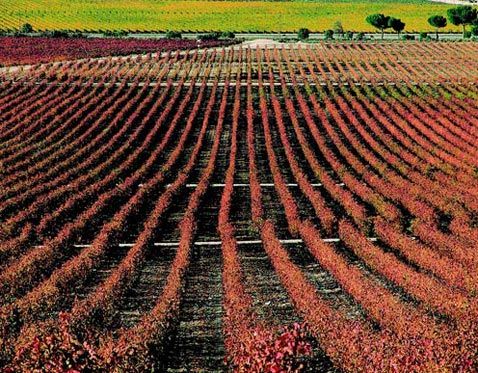
But it doesn’t stop there, it also happens to be one of the most respected wine regions in Spain as if falls at the banks of the River Duero and accounts for a large part of the denomination Ribera del Duero. The Ribera del Duero does not extend all the way along the banks of the River Duero (as its name suggests). The wines come from a specific area where nature is unique and the land is very special.
The lands included in the Ribera del Duero Designation are located on Spain`s northern plateau. Four of the provinces of the Autonomous Community of Castile & León come together in the Ribera del Duero: Burgos, Segovia, Soria and Valladolid.
The River Duero is the axis uniting more than 100 villages spread out over a wine growing belt which is some 115 Km long by 35 Km wide, of which 60 villages fall into the province of Burgos.
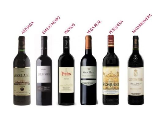
Spain’s most notable winery, Vega Sicilia is from this region and was established in 1864, but it wasn’t until the 1970’s that the region really took off internationally when the bodega Pesquera was founded and started to make red wines from Tempranillo in a more concentrated, full-bodied and fruit-driven style than most Rioja wines of the day, which were then virtually the only Spanish red wines found on export markets. Other prestigious bodegas are Emilio Moro, Protos, Arzuaga amongst others.
 .jpg)
 .jpeg)
Burgos is a land to enjoy with all the senses. The popular heritage treasured for centuries by the inhabitants of the province and of which its rich traditions and legends are a good example, its almost never-ending songs and its festivities and pilgrimages have left an incomparable trace, which confers upon the people of Burgos a unique and singular character and seasonal climate, a perfect synthesis between the European mildness and the Mediterranean luminosity.
Ver mapa más grande
BEST TIME TO VISIT:
Any time of year, but in winter it does get very cold and frequently snows, so for em the best time of year is Spring or Summer.
 2
Like
Published at 10:50 PM Comments (0)
Back to 1925: Ochagavía, Spain, Preserves a Century-Old Way of Life
Saturday, October 11, 2025
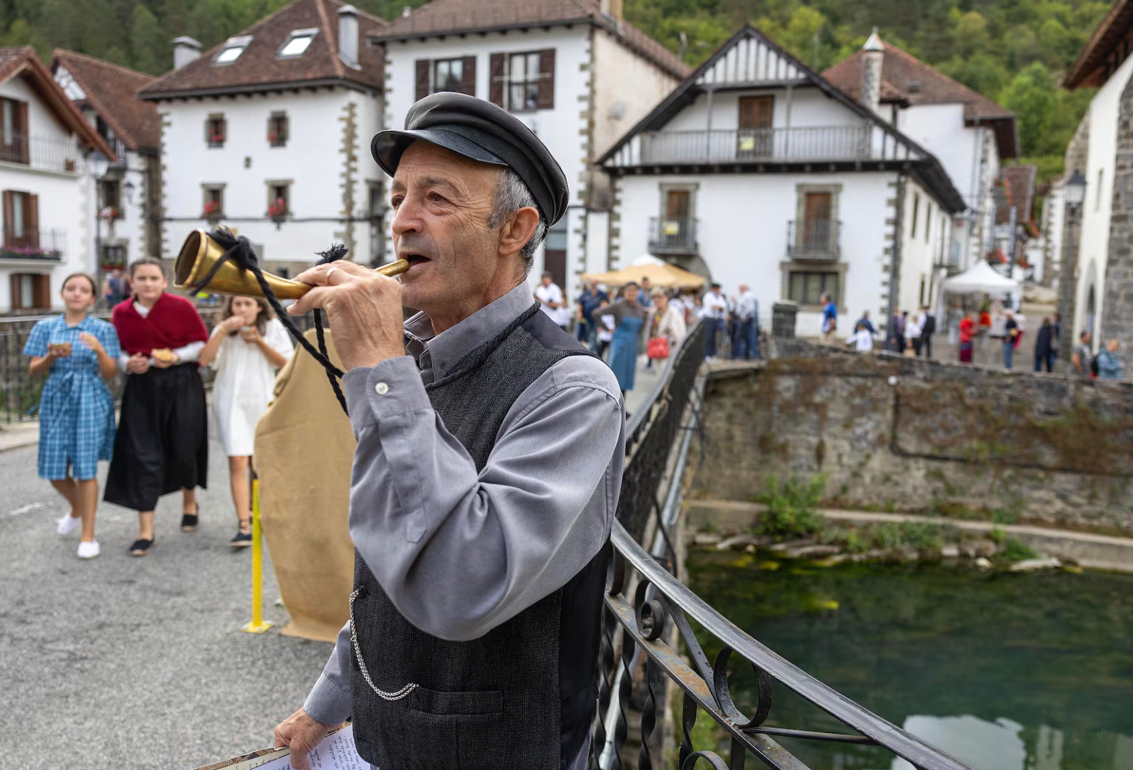
Every year, as summer draws to a close, the quaint Spanish village of Ochagavía in Spain's northern region of Navarre undergoes a stunning transformation. The village sheds the 21st century—hiding traffic signs, ATMs, and modern storefronts—to faithfully recreate life as it was in 1925. This immersive experience, known as Orhipean (meaning "beneath Ori" in Basque), draws nearly 3,000 visitors annually, all eager to witness a bygone era brought vividly to life by the local residents.
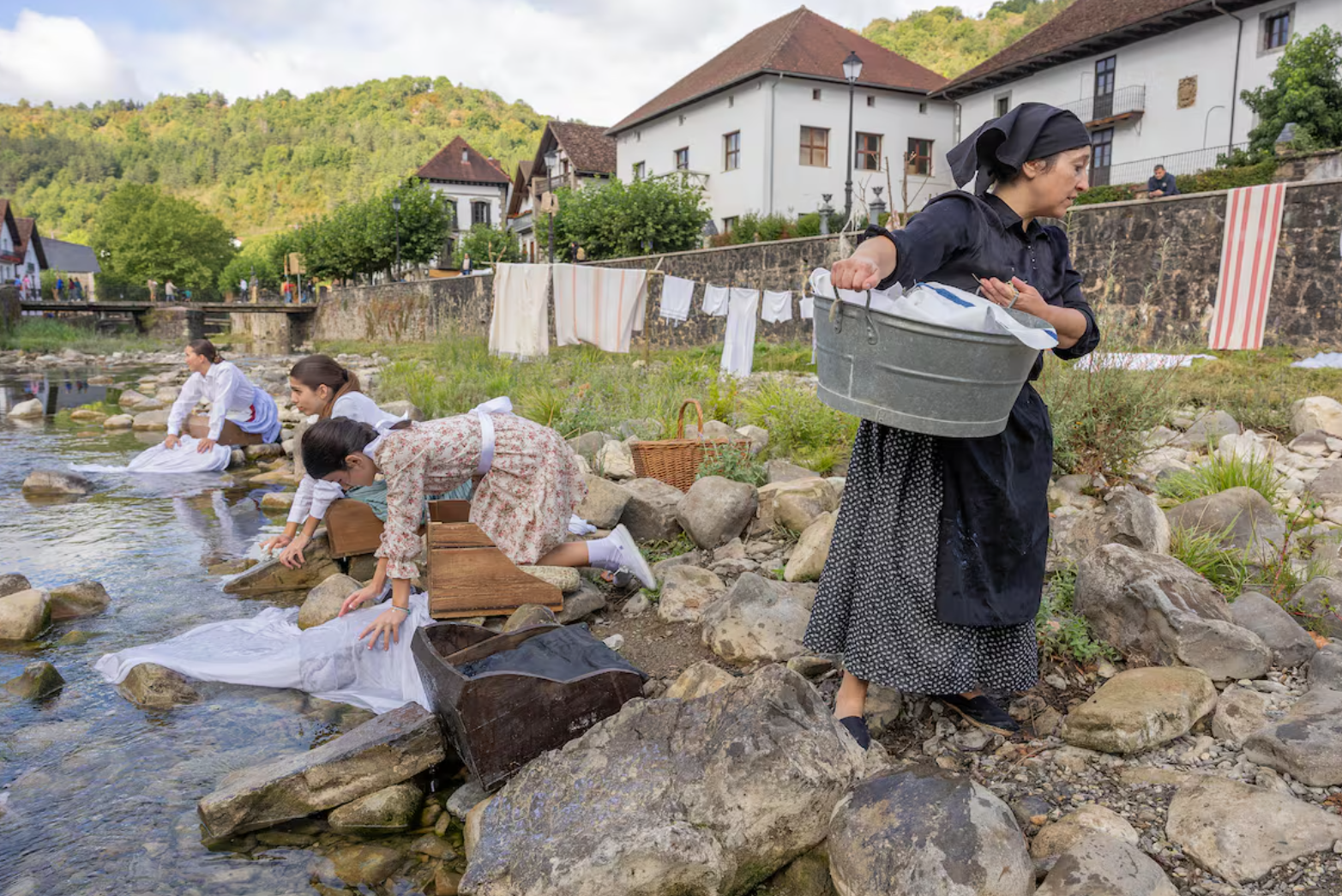
For a full weekend, Ochagavía’s approximately 500 residents—some of whom return specifically for the event—don the outfits of the 1920s to perform the forgotten trades and customs of their ancestors.
The atmosphere is thick with authenticity, largely due to the dedication of the town's older generation, who instruct the young on the proper techniques. Visitors can watch:
- Washerwomen kneeling by the river, scrubbing sheets in the traditional way.
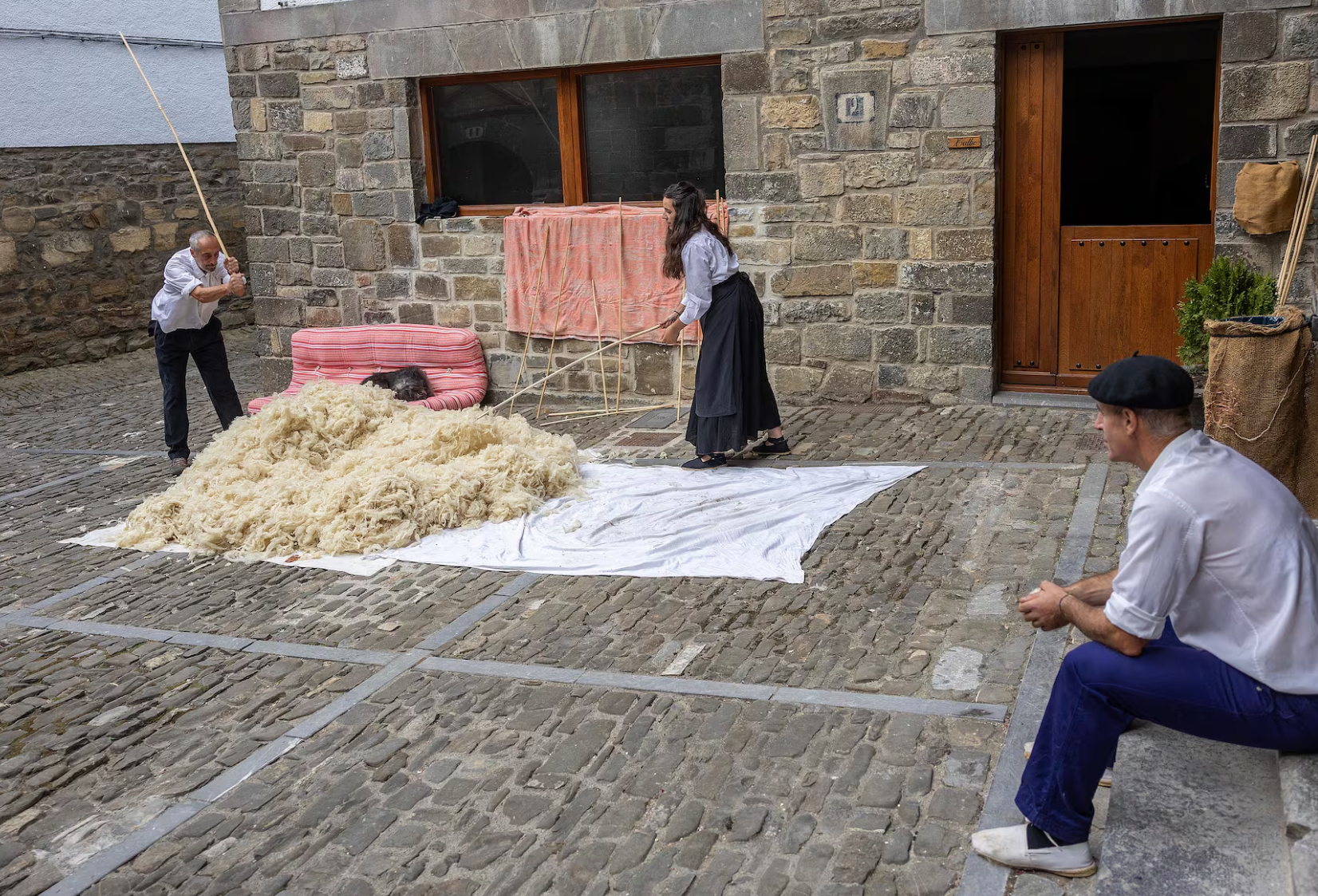
- Spinners using simple tools to process thread, a skill still held by the village's elders.
- Farmers shearing sheep with scissors and guiding livestock, including donkeys, through the cobblestone streets.
- A special, dramatic event: the "mata-txerri" or pig slaughter, where residents process the animal in the street, grinding meat and stuffing casings to make chorizo.
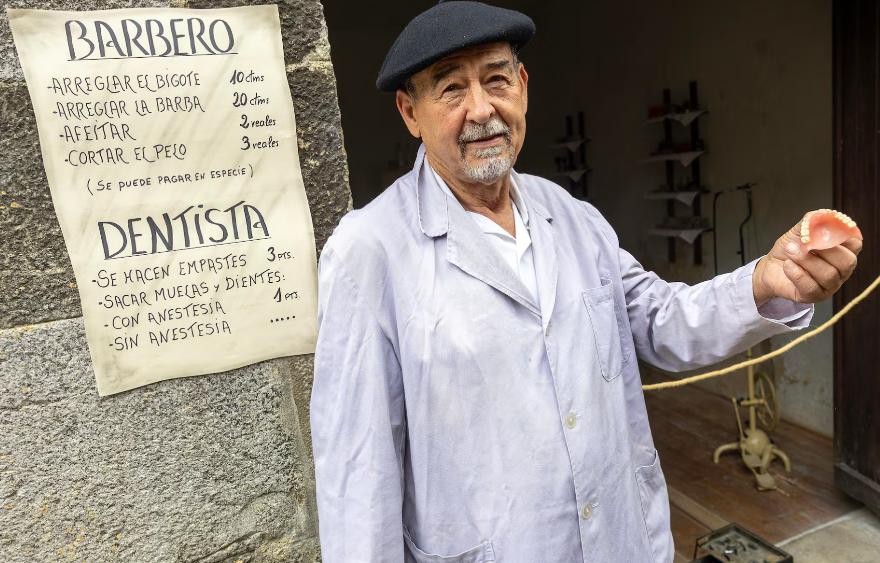
One of the most colourful attractions is the makeshift barber-dentist, a character who stands before a vintage price list. While a moustache trim costs 10 cents, a tooth extraction is priced based on bravery: free for those who endure the process without complaint, but one peseta for the "fussy" who require anaesthesia.
The commitment to detail extends beyond the public square. Homes and historical buildings are used to recreate private village life. The vestibule of a private house becomes the doctor’s office, while a Pyrenees mansion, Casa Koleto, houses a meticulously recreated old school. Here, separate schedules for boys and girls are observed, and a job advertisement for a female teacher lists strict, era-appropriate rules: "Do not marry," "do not dye your hair," and "wear at least two petticoats."
Religious customs are also revived, including the angélicas, a now-lost tradition where First Communion girls offered flowers to the Virgin Mary in May.
The Orhipean festival, which began over two decades ago, arose from a desire to turn the local celebration toward historical preservation. Organisers acknowledged that the event would not be possible without the complete involvement of the elderly, who share their living memories and family heirlooms, such as antique shoes and household items. The event’s newspaper, updated each year, offers historical context by featuring local happenings from the year 1925, detailing births, deaths, and even early morning weddings, serving as a powerful reminder of the deep roots and enduring spirit of this Navarrese community.
 2
Like
Published at 11:47 AM Comments (0)
Spam post or Abuse? Please let us know
|
|