The Forests of Spain Hide a Secret Treasure
Thursday, September 26, 2024
In the Spanish provinces of Segovia, Ávila and Valladolid a special treasure is hidden.
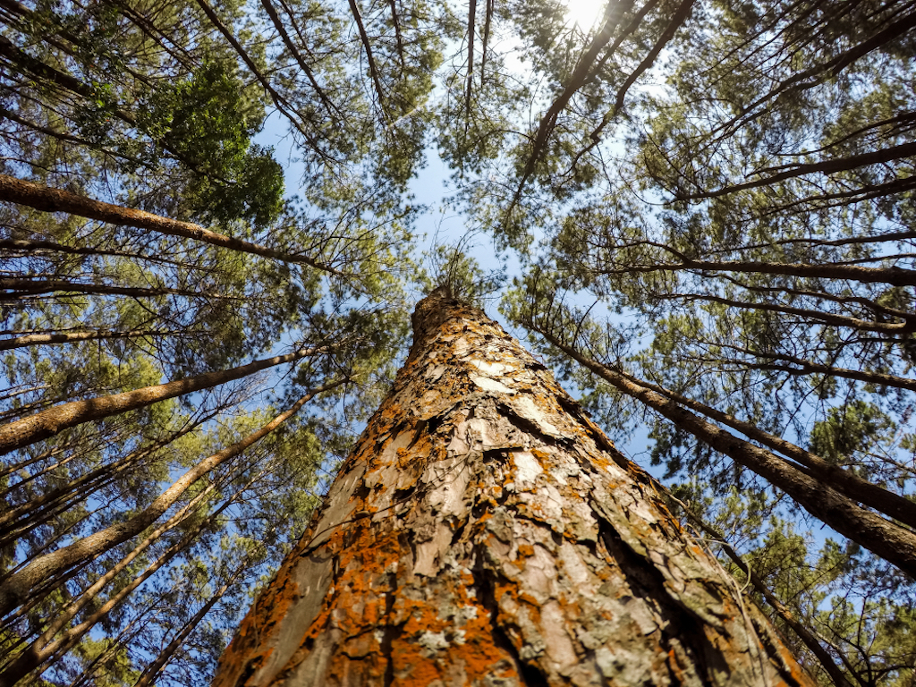
There, in the middle of Tierra de Pinares and Sierra de Gredos, a thick forest of 400,000 hectares of resinous pines extends towards the mountains.
Sheltered from the hot Spanish sun and lined with trails, this forest is a popular destination for locals and tourists. And, if you visit at the right time and look closely, you'll see workers standing by the tree trunks carrying out the centuries-old tradition of harvesting the "liquid gold" of the pine.
In Spain and much of the Mediterranean, pine resin was used to waterproof ships, treat burns, and light torches, among other things. But it was not until the 19th and 20th centuries that pine resin extraction became profitable in that Spanish region. When technology and industrialization helped convert the thick sap into plastics, varnishes, glues, tires, rubber and even food additives in the mid-19th century, the owners of the dense Pinus pinaster forests of Castilla y León saw an opportunity. And although this slow process stopped in much of the world, in the last decade it has experienced a renaissance in Castilla y León, the place with the most resin manufacturers in all of Europe and one of the last on the continent where this practice persists.
 The extraction process has remained largely unchanged since this industry began, but today's resin manufacturers have created more efficient and ergonomic tools, as well as chemicals that stimulate resin secretion. As a result, yields and productivity were greatly improved. The extraction process has remained largely unchanged since this industry began, but today's resin manufacturers have created more efficient and ergonomic tools, as well as chemicals that stimulate resin secretion. As a result, yields and productivity were greatly improved.
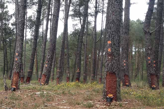
What also changed was that in the past the extraction of resin was "to the death" of the trees, using very aggressive methods. But, for some time now there has been a change "to life", with a practice in which the number of incisions in the bark is minimized, reducing damage to the tree.
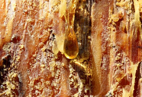
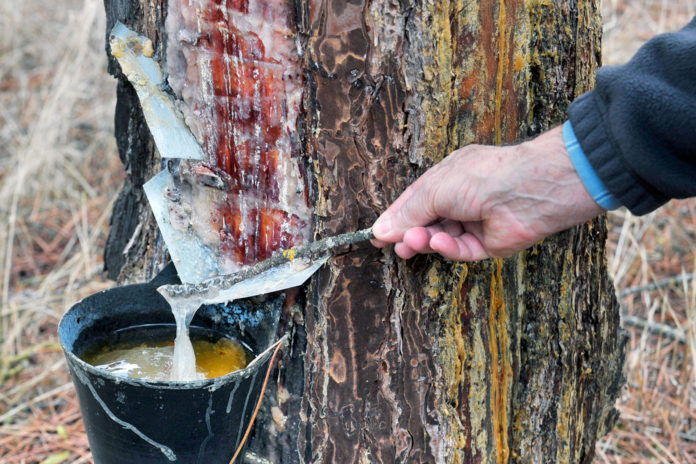
In the warmer months of March through November, local growers carefully extract the resin from the pine trees by first removing the outer layer of the tree's bark. They nail a holder and place a collection container. The extractors then use their axes to make diagonal incisions in the bark causing the trees to "bleed" and their resin to seep into the bucket. When they are full, they pour the sap into 200kg containers.
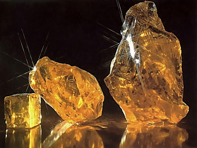
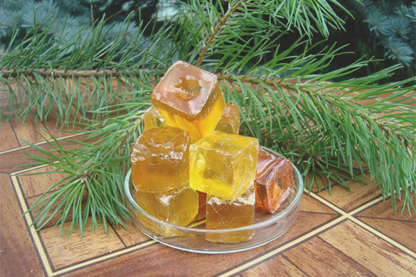
Producers send the substance to distilling factories, which extract the turpentine from the resin, which has a slimy, yellowish appearance that solidifies when cooled into shiny, amber-coloured stones. During the peak of pine resin extraction in Spain in 1961, when 55,267 tons were extracted, more than 90% came from the forests of Castilla y León. The lack of demand and the sharp fall in prices led to production falling and almost disappearing in the 1990s. Many thought that this would be the end of this Spanish tradition.
In Castilla y León, resin has not only been an economic livelihood for rural communities, but also a trade that is passed down from generation to generation. Many families have at least one person who has "bled" trees or participated in their distillation. Much of the economic and social activity in these towns has always been marked by the resin industry and the communities maintain this legacy as an important part of their culture.
Today we can see many products made from petroleum, such as plastic, for example, which is not biodegradable, can also be made from resin and break down more easily. Resin is thought to be the oil of the world today and in the future. The idea is that all uses of oil will be replaced by resin. Plastics are already being manufactured from resin. For example, in the cosmetic and pharmaceutical industry in addition to its applications in construction or in the manufacture of varnishes and glues. The forest is a great supplier of renewable resources and energy that it allows substituting petroleum products. Resin plays an important role. Pine resin advocates also believe it could offer a solution to Spain's rural exodus. According to a report by the Bank of Spain, 42% of the towns in the country are affected by depopulation because more and more young people are leaving the countryside to seek better job opportunities in the cities. This phenomenon is aggravated in Castilla y León, where 80% of the municipalities in 14 provinces are considered "in danger of extinction”. However, due to the new interest in pine resin, some young people have begun to return.
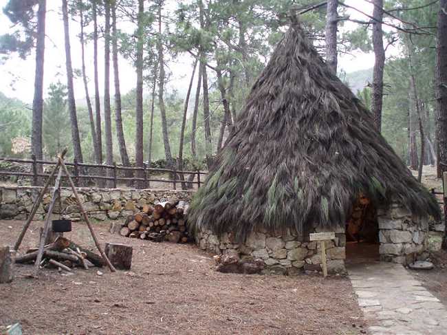 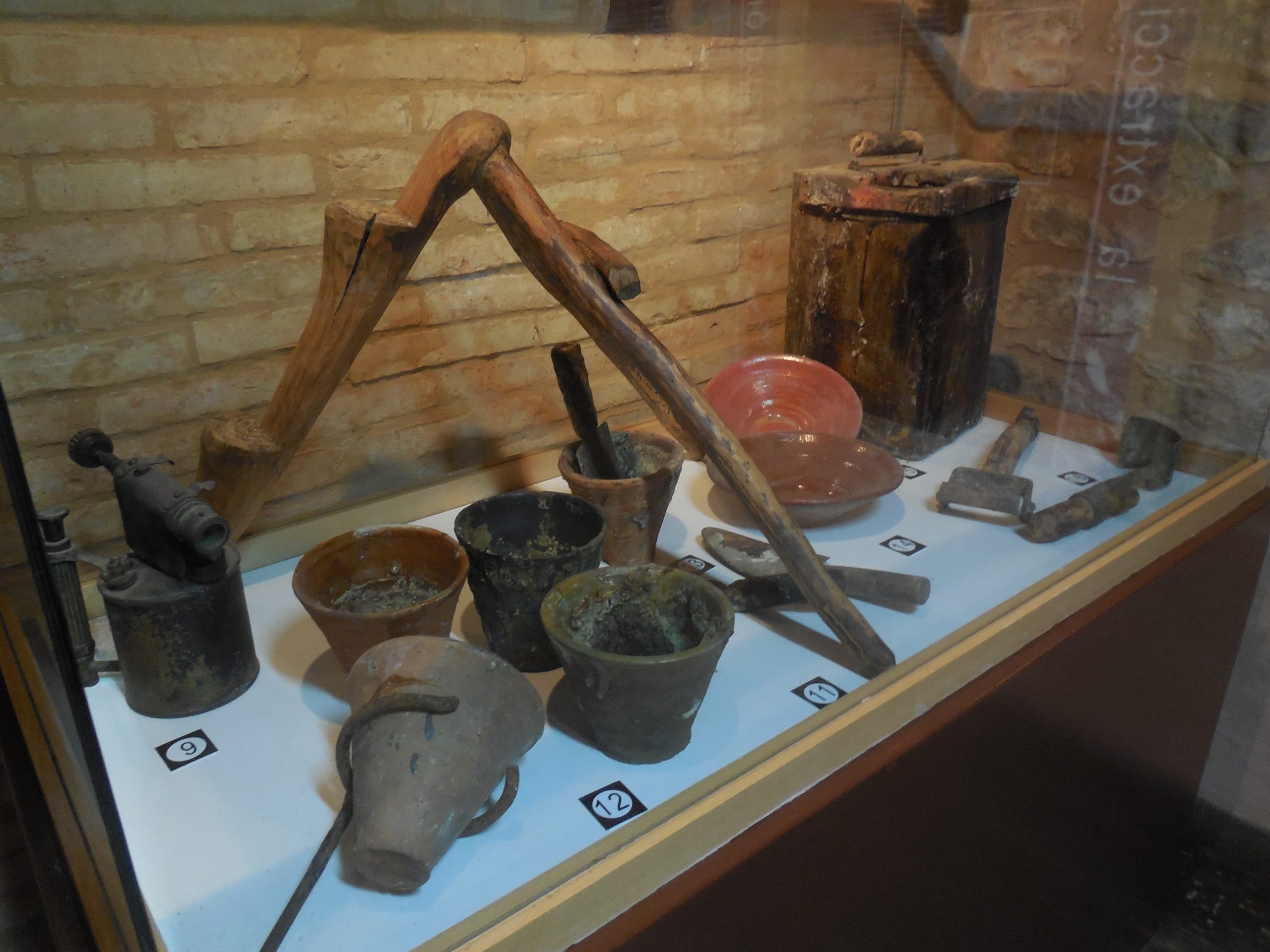
The Valle del Tiétar (Ávila) has recently applied to become a UNESCO-protected Biosphere Reserve with the intention of protecting the region. Additionally, to raise interest and attract tourism there are also several museums where visitors can see the traditional cabins where the first workers slept and appreciate old tools, and several companies offer guided tours of the "Ruta de la Resina”. On weekends, these lush forests can be filled with the sound of footsteps as tourists come to escape the hustle and bustle of nearby cities.
 2
Like
Published at 9:52 PM Comments (0)
2
Like
Published at 9:52 PM Comments (0)
A Symbol for the New World
Saturday, September 21, 2024
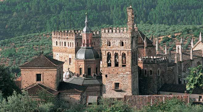
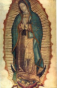
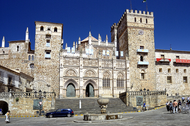
The Monastery of Santa Maria de Guadalupe is a magnificent display of religious architecture spanning four centuries, symbolising two significant events in world history that both occurred in the same year, 1492: the final expulsion of the Muslim power from the Iberian Peninsula and the discovery of America by Columbus. Its famous image of the Virgin also became the pre-eminent symbol of the Christianisation of the New World and later the Basilica of Guadalupe was built in Mexico in her honour, becoming commonly known as the Queen of Mexico and the Empress of America.
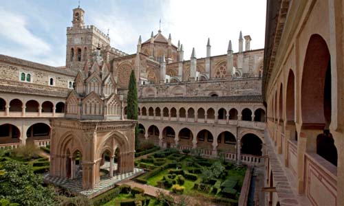
 The Monastery, the principal of the Order of St Jerome, played a very influential role in the history of Spain, being associated by the crown with important events, notably by the Catholic Kings (Los Reyes Católicos ) with the conquest of Granada and the discovery of America in 1492. The Monastery was, and remains a centre of pilgrimage. It was a cultural centre of the highest order: its hospitals and its medical school were renowned, as was its scriptorium and its library, containing a very rich collection of documents. Many famous artists were attracted to Guadalupe, including Juan de Sevilla, Francisco de Zurbarán, Vicente Carducho, and Luca Giordano. The Monastery, the principal of the Order of St Jerome, played a very influential role in the history of Spain, being associated by the crown with important events, notably by the Catholic Kings (Los Reyes Católicos ) with the conquest of Granada and the discovery of America in 1492. The Monastery was, and remains a centre of pilgrimage. It was a cultural centre of the highest order: its hospitals and its medical school were renowned, as was its scriptorium and its library, containing a very rich collection of documents. Many famous artists were attracted to Guadalupe, including Juan de Sevilla, Francisco de Zurbarán, Vicente Carducho, and Luca Giordano.
The harmony between the buildings, which occupy 20,000m2 and the classic works of art that it contains within the monastery and its museum, make it an outstanding example of Spanish history. The site is one of great beauty, overlooking a valley surrounded by high mountains, notably the Villuercas, and containing abundant vegetation.
At the end of the 13th century, a Cáceres shepherd discovered close to the River Guadalupe a statue of the Virgin Mary that had been buried by Christians from Seville around 714 when fleeing before the Moorish invaders. The shepherd built a chapel to house the statue. A few years later it became a church, enlarged in 1337 by the command of Alfonso XI, who visited it on several occasions. This king invoked the protection of Our Lady of Guadalupe for the battle of Salado in 1340 and, following his victory declared the church a royal sanctuary, founding a secular priory there. For 447 years under the Hieronimite Order, the monastery was the most important in Spain and one of the most famous in the Christian world. In 1835 the order passed responsibility to the Archdiocese of Toledo, which handed it over to the Franciscan order in 1908.
Ver mapa más grande
2
Like
Published at 12:47 PM Comments (0)
Discovering Huelva and its Pride and Joy
Saturday, September 14, 2024
Between the Guadalquivir and Guadiana estuaries, the Huelva coast is a series of spectacular beaches, idyllic natural spaces and charming fishing villages with a true seaside feel where you can find the tastiest dishes on the Atlantic coast. The sea offers many delicacies, but only one stands out above the rest in the region's gastronomy. The white prawn, ‘The Pearl of Huelva’.
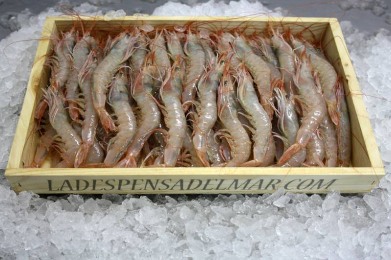
From east to west, the Costa de la Luz (Light Coast) starts at Tarifa and ends at the mouth of the Guadiana, the river border between Spain and Portugal. Many spots vie to be the most beautiful in the region. But on its coastline the white prawn has no need to compete - there is no rival to its flavour. With long whiskers and a flat body, the white prawn is the queen of the markets and tapas bars in Huelva. The inshore fleet catches it using traditional methods from the sandy seabeds of the coast and its thin skin, in a slightly pink tone, needs the right cooking time and a pinch of salt to turn this seafood into one of the finest delicacies of Huelva's cuisine.
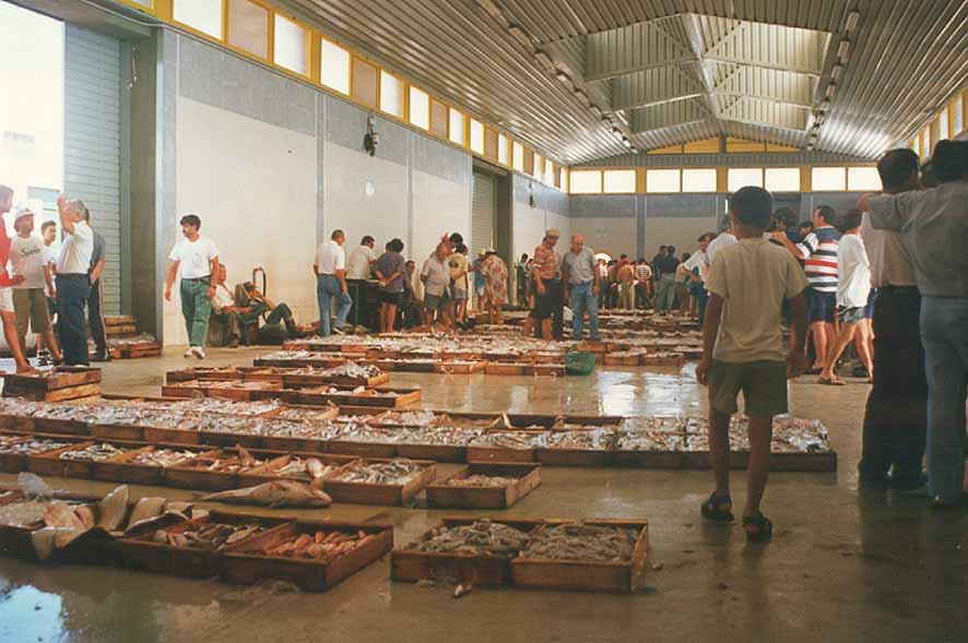
There are a wide variety of prawns, but the one with the highest quality and culinary value is the Huelva coastal prawn, auctioned every day in the fish markets of Ayamonte, Huelva, Isla Cristina and Punta Umbría. Its meat is highly valued and it is prepared in many ways, although boiled and grilled are the most popular. To prepare them, boil water with salt and add the prawns when the water starts to boil. After a few minutes over the heat, leave them to rest in a bowl with water, ice and salt. If you want to grill them, put a layer of coarse salt on the grill, heat it and sear the prawns on both sides. Afterwards, you just need to season them with a generous handful of coarse salt. The Huelva white prawn, like other shellfish, has a high nutritional value and is a source of proteins, phosphorus, selenium, iron, calcium and vitamins such as B12 and niacin. One hundred grammes provide over 80% of the recommended daily amount of iodine for women over 16, and it must be consumed in moderation as its cholesterol levels are relatively high.
So for those of you who don’t know Huelva here is a short tour of this wonderful region…
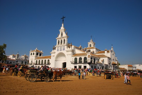
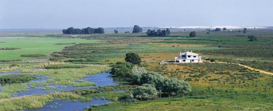
If one starts at the marshes of Almonte. Here you can find the village of El Rocío, where thousands of pilgrims flock each year, on the first Monday of Pentecost, to honour the Virgin, their Virgin. It is the most popular, traditional and festive pilgrimage in Andalusia. The shrine (built in the seventies), the sandy streets at the doors of the brotherhoods, and the views of the marshes are must-sees.
The road takes you to Matalascañas. There you can enjoy the long Atlantic beach, take a look at its impressive lighthouse and stroll through the Dune Park, sign-posted along a path through junipers and pines. If you still have strength after this trip into nature, you can visit the Marine World Museum (Ctra. Matalascañas a Mazagón) and turn off at El Acebuche (Ctra. A-483 Km. 38.7), which is the Visitor Reception Centre for the National Park of Doñana and where you can find all the information you need to see everything there is to see in the park. A road runs through the National Park of Doñana and connects Torre de la Higuera beach (Matalascañas) with Mazagón beach. There are several recreational areas before reaching the turn-off leading to Parador beach, with spectacular sandstone cliffs such as Asperillo cliff.
From Mazagón to Huelva the landscape becomes more industrial and ends at La Rábida, the birthplace of the discovery of the New World. Here you can visit the José Celestino Mutis botanical garden, free of charge, with species from all five continents; the Muelle de las Carabelas dock with a reproduction of the three ships that took Columbus to America, and the monastery of Santa María de La Rábida (Diseminado De la Rábida; 959 350 411). Opposite the monastery, on the other side of the Huelva estuary, you can see the mouth of the Odiel and its marshes, also a protected Natural Landscape. Next the route takes you to the capital. At the entrance, 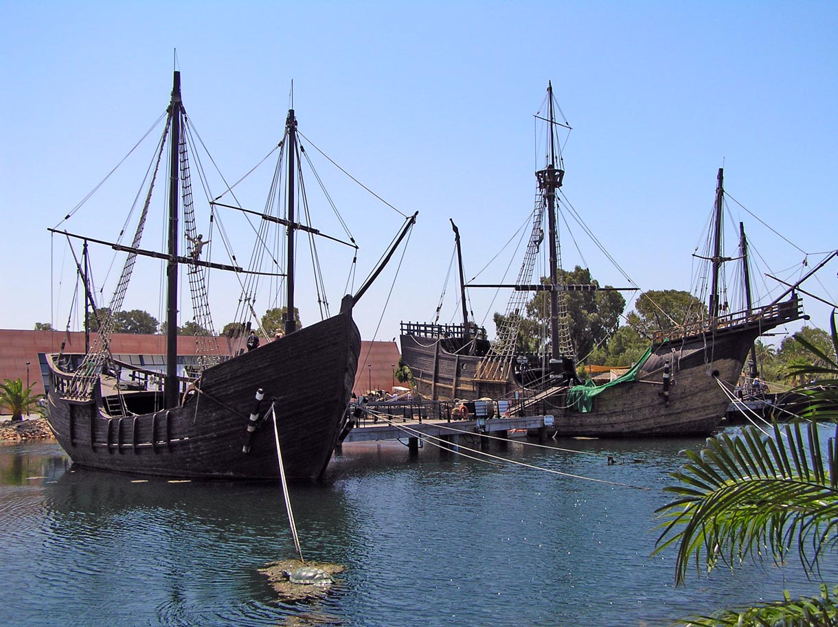 cross the bridge over the river Tinto to join a road that leads along the Juan Carlos I dam to the lighthouse, opposite the refinery. Punta Umbría, one of Huelva's official summer destinations and the next stop on the route, is a stone's throw from the city. Wooden walkways lead to the famous dune beaches of Enebrales and Mata Negra. After a relaxing swim, continue the route to El Portil, at the edge of another of the most representative protected natural spaces on the Costa de la Luz: the mouth of the river Piedras and La Flecha del Rompido, a 10 km sandbar that extends towards El Terrón, home to one of the most important colonies of waterfowl such as the pintail, cormorant or the little egret. From here, head towards La Antilla, a long family beach with a great promenade, palm trees and terraces that almost touch the sand. cross the bridge over the river Tinto to join a road that leads along the Juan Carlos I dam to the lighthouse, opposite the refinery. Punta Umbría, one of Huelva's official summer destinations and the next stop on the route, is a stone's throw from the city. Wooden walkways lead to the famous dune beaches of Enebrales and Mata Negra. After a relaxing swim, continue the route to El Portil, at the edge of another of the most representative protected natural spaces on the Costa de la Luz: the mouth of the river Piedras and La Flecha del Rompido, a 10 km sandbar that extends towards El Terrón, home to one of the most important colonies of waterfowl such as the pintail, cormorant or the little egret. From here, head towards La Antilla, a long family beach with a great promenade, palm trees and terraces that almost touch the sand.
Next to the coast, the road offers views of the sea and takes you to Isla Cristina. The town's large inshore fleet is a leader in white prawn fishing, which you can buy at a good price in the fish market, famous since the 18th century. You must visit the area for some tapas. As well as its magnificent beaches (Islantilla, Centro or Punta del Caimán), its tapas bars are a good place for a rest. The route ends in Ayamonte, the westernmost town in the province, on the banks of the Guadiana. From the Villa district you can see the estuary, the International bridge and the Portuguese town of Vila Real de Santo António. The church of the Divino Salvador, Pozo Nuevo (New Well) and the Museum of the Brotherhood of La Soledad (Plaza de San Francisco), which houses pieces from the local Holy Week celebrations, are must-visits along the road to the area of La Ribera, which puts the finishing touch to the route with its fishing ports and marinas, and its busy streets around the Plaza de La Laguna.
1
Like
Published at 1:41 PM Comments (0)
The Salt Valley of Añana
Friday, September 6, 2024
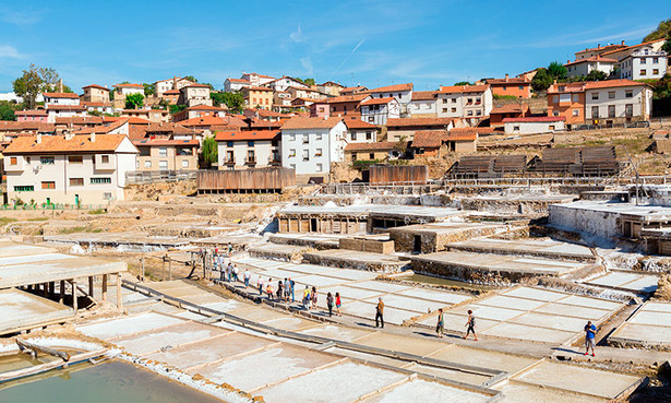
Salt has always been associated with the sea or on some occasions, salt mountains and even mines, but in Northern Spain, in the Basque country near the town of Álava, there is a rather unusual saltern where nature does practically all the work and has been for millenniums. This privileged location is called the Salt Valley of Añana.
 The first thing you might ask yourself when you see this marvel is how and why is salt produced here and not someplace else? Especially when there is no mine visible. The answer is a geological phenomenon known as a Diapir. Roughly speaking, the area that makes up the valley was covered by a big ocean more than 200 million years ago that eventually dried up, leaving a layer of salt several kilometres thick. With time, this layer was covered by new stratum that hid it from sight forever. Because of the different densities between layers (similar to what happens when we mix water with oil), in some very specific points of the valley, the salt emerged to the surface. And those are the places where we can find the underground salt deposits. But how do you extract it? The answer is simple: either by mining which is hard work and expensive or taking advantage of the saltwater (brine) springs that are created after freshwater has filtered through the layers of solid salt diluting it and bring it to the surface, and enabling a 200 million-year-old mineral to reach your kitchen table. The salt works of Añana belong to the large group of neighbours in fact almost the entire population of the village owns shares in the salt plant as they are fortunate enough to have several springs that provide around 260.000 litres of brine daily with a concentration near to saturation point. The first thing you might ask yourself when you see this marvel is how and why is salt produced here and not someplace else? Especially when there is no mine visible. The answer is a geological phenomenon known as a Diapir. Roughly speaking, the area that makes up the valley was covered by a big ocean more than 200 million years ago that eventually dried up, leaving a layer of salt several kilometres thick. With time, this layer was covered by new stratum that hid it from sight forever. Because of the different densities between layers (similar to what happens when we mix water with oil), in some very specific points of the valley, the salt emerged to the surface. And those are the places where we can find the underground salt deposits. But how do you extract it? The answer is simple: either by mining which is hard work and expensive or taking advantage of the saltwater (brine) springs that are created after freshwater has filtered through the layers of solid salt diluting it and bring it to the surface, and enabling a 200 million-year-old mineral to reach your kitchen table. The salt works of Añana belong to the large group of neighbours in fact almost the entire population of the village owns shares in the salt plant as they are fortunate enough to have several springs that provide around 260.000 litres of brine daily with a concentration near to saturation point.
Looking at it today, it's almost inconceivable that something so abundant and low cost would have had such historical importance. However, it has to be taken into consideration that salt was, and is, essential in a lot of industrial processes and also in human and animal diet. It was even more important before the development of industrial cooling since it was one of the most effective methods of preserving food. As a matter of fact, salt was the cause of war and forced peace, the cause of death and crownings, of richness and poorness, the creation and destruction of towns and cities, and of course, greed. This is very evident in the history of Añana... The first traces of settlements near the salt springs date back 5,000 years. Since then their inhabitants adapted the area to their interests and left their mark. In the Iron Age, they left the bottom of the slopes and built their houses on easily defendable elevated sites and in Roman times, the settlement system suffered a big change. Probably due to the importance of the salt of Añana, just a few kilometres from the springs, near the modern-day town of Espejo, emerged a city called Salionca. Its economic development attracted the surrounding population to live in this thriving city. Around the fifth century, Salionca was destroyed after suffering a major fire and the city was abandoned and some of its inhabitants went to live and work in the salt valley.
The springs bring the brine to the surface level in a natural and continuous way, which allows its use without any need for drilling or pumping. It is entirely ecological. There are a number of them in the Salt Valley and its surroundings, but only four of them (Santa Engracia, La Hontana, El Pico and Fuentearriba) are usable because their flow is permanent (about 3 litres per second) and salinity is near saturation point (210 grams per litre).
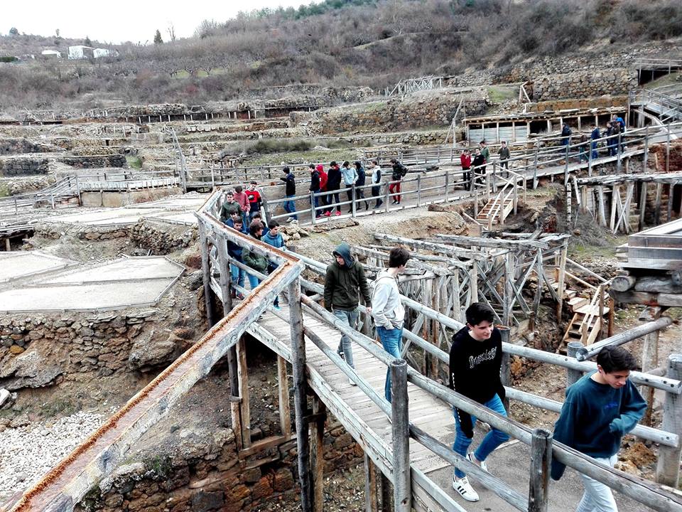
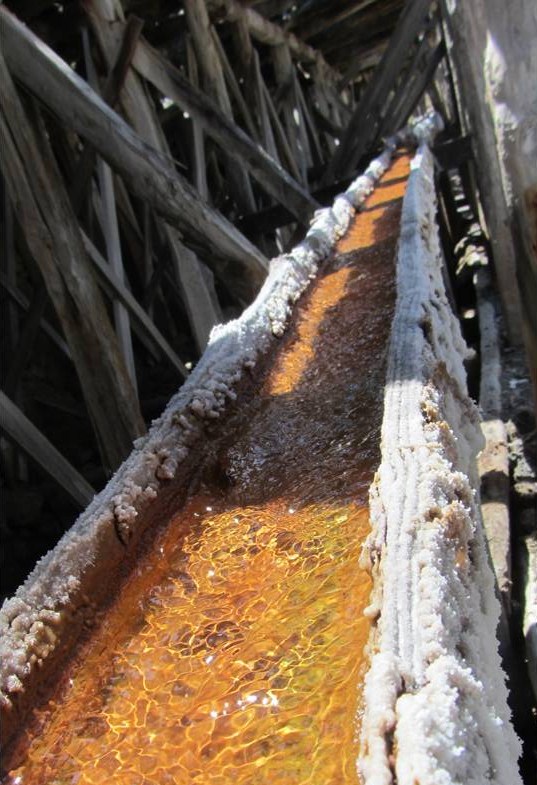
The saltwater is transported and distributed continuously and by using gravity through a complex network of canals called 'rollos'. Although originally many of them were simple trenches dug in the ground, they eventually were replaced by hollowed-out pine logs. The main distribution system, with more than three kilometres in total length - starts at the fountain of Santa Engracia in a single channel which is divided within a distribution tank called a 'Partidero': on the eastern slope of the valley, the Royo de Suso flows down and on the west slope the Quintana.
Deposits are also imperative for the salt farm. Currently, there are 848 wells for storage and way this water is distributed to the different threshing pits have always been an issue of dispute, as they are each privately owned and maintained by their respective owners. Thus there is a need for a complex distribution rulebook for the use of the brine, known as the Master Book. This ultimately keeps the peace between numerous owners.
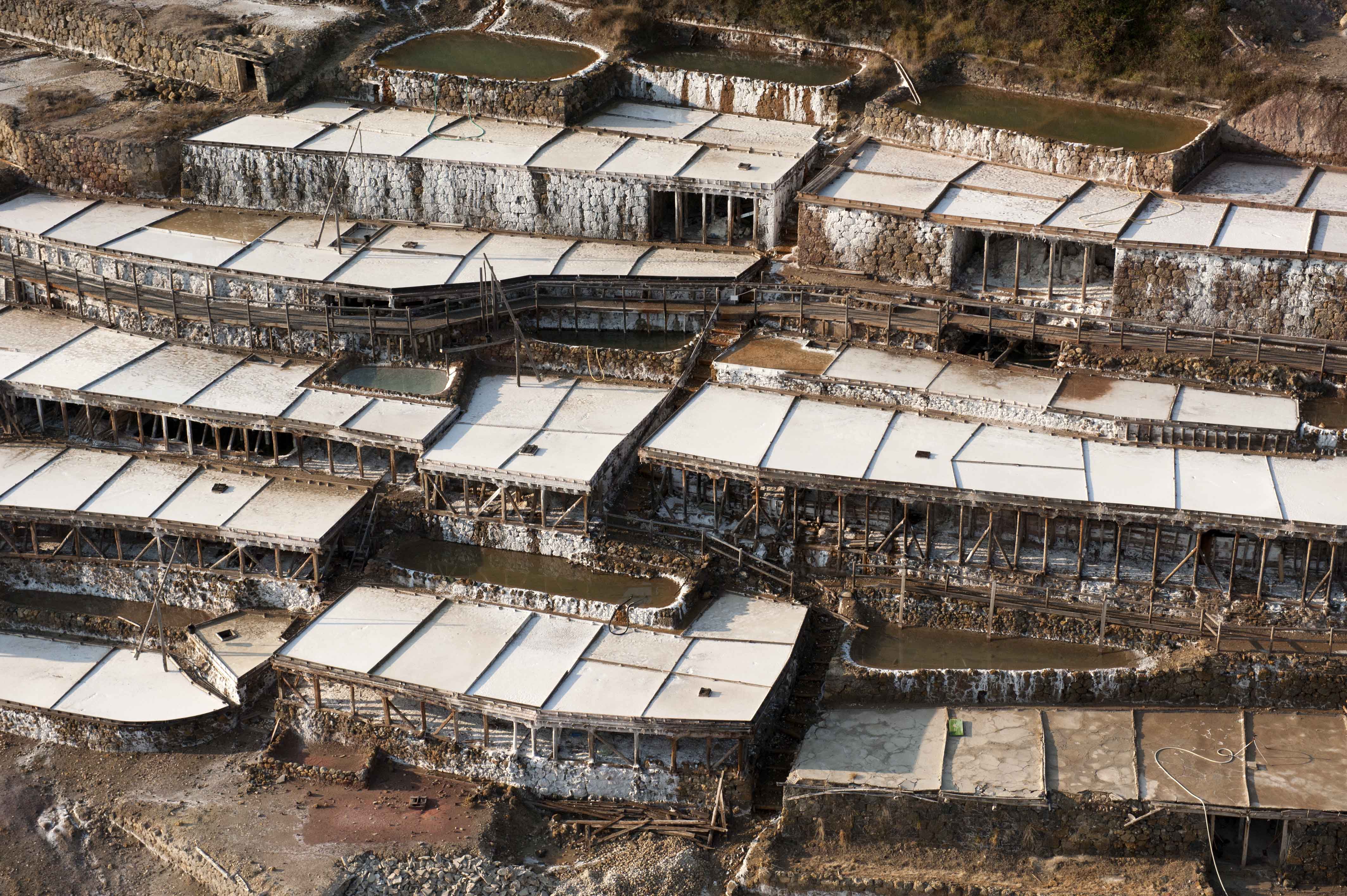
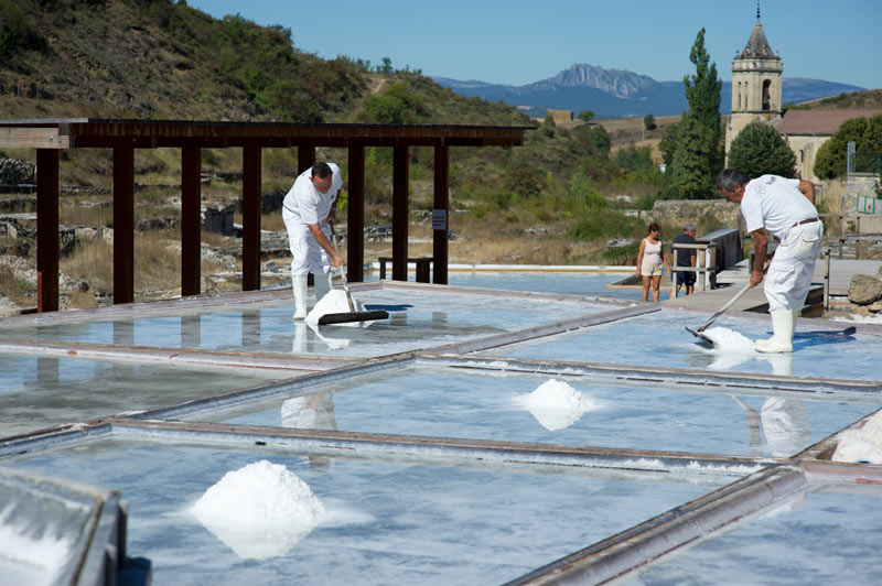
The production of salt in Añana is based on the evaporation of water from the brine by natural means. To do so, saltwater is poured on horizontal surfaces called 'balsas' (rafts) or threshing pits whose surface varies between twelve and twenty square meters. The groups of threshing pits worked by the same owner are called farms. They are adapted to the complex topography of the site, both in form and height, resulting in complicated shapes that cover most of the Salt Valley territory. The point of maximum splendour was in the middle of the twentieth century when in the valley there were 5648 threshing pits in operation.
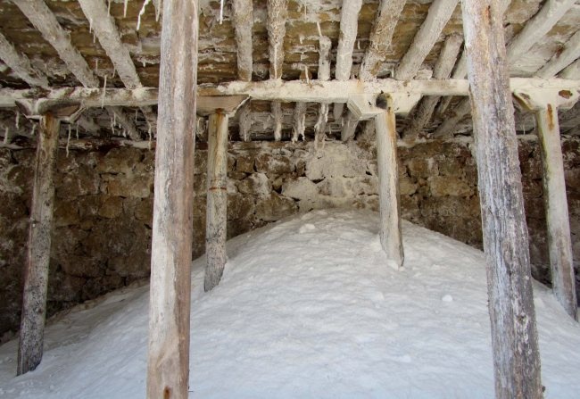
The buildings destined to store the salt in Añana can be divided into two types: private and public. The former was originally owned by salt workers. Such structures are mainly located under the threshing pits, taking advantage of existing holes between the walls of the terraces and the evaporation platforms. This building technique greatly facilitates the filling, because the salt is simply discharged by small holes in the surface of the threshing pits called 'bouquets' (sluices). The main function of these buildings is to hold the salt until transported to public warehouses located outside the valley. Añana had four of these buildings, which were built and controlled by the State during the monopoly of salt. They became known as El Grande, El Torco, Santa Ana and El Almacenillo del Campo. The whole production was kept there at the end of the season. In total, they could store about 110,113 “fanegas” of salt (approximately 5,681,830 kg). Now it is all in hands of the local community and although they could be extracting salt most of the year, they limit it to a few months a year when the temperatures are high enough to achieve fast evaporation, thus reducing the costs of labour per kg produced.
If you happen to be in the area it is certainly worth a visit, on-site there are tourist guides and trips around the valley and a museum with a shop where you can choose from a vast variety of different salts varying from “Flor de Sal” the most valuable; known as white gold and seasoned salts amongst others. This is one lucky village that has a permanent source of income no matter what the economic climate is, in fact, the only thing that would affect its production would be the lack of sunshine and in Spain that is not very likely.
3
Like
Published at 10:54 PM Comments (0)
Spam post or Abuse? Please let us know
|
|